Caplong
Caplong | |
|---|---|
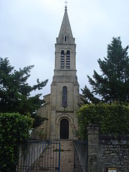 The church in Caplong | |
show Location of Caplong | |
 Caplong | |
| Coordinates: 44°46′41″N 0°08′19″E / 44.7781°N 0.1386°ECoordinates: 44°46′41″N 0°08′19″E / 44.7781°N 0.1386°E | |
| Country | France |
| Region | Nouvelle-Aquitaine |
| Department | Gironde |
| Arrondissement | Libourne |
| Canton | Le Réolais et Les Bastides |
| Intercommunality | Pays Foyen |
| Government | |
| • Mayor (2020–2026) | Magali Verite[1] |
| Area 1 | 9.27 km2 (3.58 sq mi) |
| Population (Jan. 2018)[2] | 223 |
| • Density | 24/km2 (62/sq mi) |
| Time zone | UTC+01:00 (CET) |
| • Summer (DST) | UTC+02:00 (CEST) |
| INSEE/Postal code | 33094 /33220 |
| Elevation | 43–118 m (141–387 ft) (avg. 76 m or 249 ft) |
| 1 French Land Register data, which excludes lakes, ponds, glaciers > 1 km2 (0.386 sq mi or 247 acres) and river estuaries. | |


Caplong (French pronunciation: [kaplɔ̃]; Occitan: Cablong) is a commune in the Gironde department in Nouvelle-Aquitaine in southwestern France.
Population[]
| Year | Pop. | ±% |
|---|---|---|
| 1962 | 197 | — |
| 1968 | 246 | +24.9% |
| 1975 | 196 | −20.3% |
| 1982 | 184 | −6.1% |
| 1990 | 188 | +2.2% |
| 1999 | 204 | +8.5% |
| 2008 | 206 | +1.0% |
See also[]
References[]
- ^ "Répertoire national des élus: les maires". data.gouv.fr, Plateforme ouverte des données publiques françaises (in French). 2 December 2020.
- ^ "Populations légales 2018". INSEE. 28 December 2020.
| Wikimedia Commons has media related to Caplong. |
This Gironde geographical article is a stub. You can help Wikipedia by . |
Categories:
- Communes of Gironde
- Gironde geography stubs