Dombasle-sur-Meurthe
Dombasle-sur-Meurthe | |
|---|---|
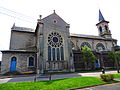
 Saint Basle church | |
 Coat of arms | |
show Location of Dombasle-sur-Meurthe | |
 Dombasle-sur-Meurthe | |
| Coordinates: 48°37′32″N 6°21′02″E / 48.6256°N 6.3506°ECoordinates: 48°37′32″N 6°21′02″E / 48.6256°N 6.3506°E | |
| Country | France |
| Region | Grand Est |
| Department | Meurthe-et-Moselle |
| Arrondissement | Nancy |
| Canton | Lunéville-1 |
| Intercommunality | |
| Government | |
| • Mayor (2020–2026) | David Fischer |
| Area 1 | 11.21 km2 (4.33 sq mi) |
| Population (Jan. 2018)[1] | 9,694 |
| • Density | 860/km2 (2,200/sq mi) |
| Time zone | UTC+01:00 (CET) |
| • Summer (DST) | UTC+02:00 (CEST) |
| INSEE/Postal code | 54159 /54110 |
| Elevation | 203–320 m (666–1,050 ft) (avg. 216 m or 709 ft) |
| Website | http://www.ville-dombasle.fr/ |
| 1 French Land Register data, which excludes lakes, ponds, glaciers > 1 km2 (0.386 sq mi or 247 acres) and river estuaries. | |


Dombasle-sur-Meurthe (French pronunciation: [dɔ̃bal syʁ mœʁt], literally Dombasle on Meurthe) is a commune in the Meurthe-et-Moselle department in north-eastern France, close to the city of Nancy.
History[]
Dombasle is one of the main production sites for sodium carbonate in the world, as Solvay created there in 1873 one of its oldest production plant. This sodium bicarbonate production plant is a key economic actor in Nancy region.[2] The remains of the castle were destroyed in 1963.[3][4]
See also[]
Gallery[]
Eglise Saint-Basle

Ancient church

Chapelle


References[]
| Wikimedia Commons has media related to Dombasle-sur-Meurthe. |
| show Authority control |
|---|
This Meurthe-et-Moselle geographical article is a stub. You can help Wikipedia by . |
Categories:
- Communes of Meurthe-et-Moselle
- Meurthe-et-Moselle geography stubs