Francheville, Meurthe-et-Moselle
Francheville | |
|---|---|
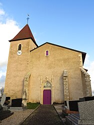 The church in Francheville | |
 Coat of arms | |
show Location of Francheville | |
 Francheville | |
| Coordinates: 48°44′21″N 5°55′56″E / 48.7392°N 5.9322°ECoordinates: 48°44′21″N 5°55′56″E / 48.7392°N 5.9322°E | |
| Country | France |
| Region | Grand Est |
| Department | Meurthe-et-Moselle |
| Arrondissement | Toul |
| Canton | Le Nord-Toulois |
| Intercommunality | CC Terres Touloises |
| Government | |
| • Mayor (2020–2026) | Michel Rosso[1] |
| Area 1 | 10.94 km2 (4.22 sq mi) |
| Population (Jan. 2018)[2] | 284 |
| • Density | 26/km2 (67/sq mi) |
| Time zone | UTC+01:00 (CET) |
| • Summer (DST) | UTC+02:00 (CEST) |
| INSEE/Postal code | 54208 /54200 |
| Elevation | 203–238 m (666–781 ft) (avg. 210 m or 690 ft) |
| 1 French Land Register data, which excludes lakes, ponds, glaciers > 1 km2 (0.386 sq mi or 247 acres) and river estuaries. | |


Francheville (French pronunciation: [fʁɑ̃ʃvil] (![]() listen)) is a commune in the Meurthe-et-Moselle department in north-eastern France.
listen)) is a commune in the Meurthe-et-Moselle department in north-eastern France.
See also[]
References[]
- ^ "Répertoire national des élus: les maires". data.gouv.fr, Plateforme ouverte des données publiques françaises (in French). 2 December 2020.
- ^ "Populations légales 2018". INSEE. 28 December 2020.
| Wikimedia Commons has media related to Francheville (Meurthe-et-Moselle). |
This Meurthe-et-Moselle geographical article is a stub. You can help Wikipedia by . |
Categories:
- Communes of Meurthe-et-Moselle
- Meurthe-et-Moselle geography stubs