Gondrecourt-Aix
Gondrecourt-Aix | |
|---|---|
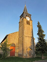 The church in Gondrecourt | |
 Coat of arms | |
show Location of Gondrecourt-Aix | |
 Gondrecourt-Aix | |
| Coordinates: 49°14′47″N 5°46′12″E / 49.2464°N 5.77°ECoordinates: 49°14′47″N 5°46′12″E / 49.2464°N 5.77°E | |
| Country | France |
| Region | Grand Est |
| Department | Meurthe-et-Moselle |
| Arrondissement | Briey |
| Canton | Pays de Briey |
| Intercommunality | Orne Lorraine Confluences |
| Government | |
| • Mayor (2020–2026) | Hervé Lacolombe |
| Area 1 | 12.28 km2 (4.74 sq mi) |
| Population (Jan. 2018)[1] | 176 |
| • Density | 14/km2 (37/sq mi) |
| Time zone | UTC+01:00 (CET) |
| • Summer (DST) | UTC+02:00 (CEST) |
| INSEE/Postal code | 54231 /54800 |
| Elevation | 242–276 m (794–906 ft) (avg. 250 m or 820 ft) |
| 1 French Land Register data, which excludes lakes, ponds, glaciers > 1 km2 (0.386 sq mi or 247 acres) and river estuaries. | |


Gondrecourt-Aix (French pronunciation: [ɡɔ̃dʁəkuʁ ɛks]) is a commune in the Meurthe-et-Moselle department in north-eastern France.
Geography[]
The two hamlets in the commune lie on the right bank of the Othain, which has its source in the southern part of the commune, then flows northwestward through the commune.
See also[]
References[]
- ^ "Populations légales 2018". INSEE. 28 December 2020.
| Wikimedia Commons has media related to Gondrecourt-Aix. |
This Meurthe-et-Moselle geographical article is a stub. You can help Wikipedia by . |
Categories:
- Communes of Meurthe-et-Moselle
- Meurthe-et-Moselle geography stubs