Landiras
Landiras | |
|---|---|
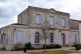 Town hall | |
 Coat of arms | |
show Location of Landiras | |
 Landiras | |
| Coordinates: 44°34′06″N 0°24′51″W / 44.5683°N 0.4142°WCoordinates: 44°34′06″N 0°24′51″W / 44.5683°N 0.4142°W | |
| Country | France |
| Region | Nouvelle-Aquitaine |
| Department | Gironde |
| Arrondissement | Langon |
| Canton | Les Landes des Graves |
| Intercommunality | Convergence Garonne |
| Government | |
| • Mayor (2020–2026) | Jean-Marc Pelletant[1] |
| Area 1 | 59.75 km2 (23.07 sq mi) |
| Population (Jan. 2018)[2] | 2,197 |
| • Density | 37/km2 (95/sq mi) |
| Time zone | UTC+01:00 (CET) |
| • Summer (DST) | UTC+02:00 (CEST) |
| INSEE/Postal code | 33225 /33720 |
| Elevation | 13–83 m (43–272 ft) (avg. 41 m or 135 ft) |
| 1 French Land Register data, which excludes lakes, ponds, glaciers > 1 km2 (0.386 sq mi or 247 acres) and river estuaries. | |


Landiras is a commune in the Gironde department in Nouvelle-Aquitaine in southwestern France.
Population[]
| Year | Pop. | ±% |
|---|---|---|
| 1962 | 1,126 | — |
| 1968 | 1,132 | +0.5% |
| 1975 | 1,089 | −3.8% |
| 1982 | 1,230 | +12.9% |
| 1990 | 1,418 | +15.3% |
| 1999 | 1,506 | +6.2% |
| 2008 | 1,969 | +30.7% |
See also[]
References[]
- ^ "Répertoire national des élus: les maires". data.gouv.fr, Plateforme ouverte des données publiques françaises (in French). 2 December 2020.
- ^ "Populations légales 2018". INSEE. 28 December 2020.
| Wikimedia Commons has media related to Landiras. |
This Gironde geographical article is a stub. You can help Wikipedia by . |
Categories:
- Communes of Gironde
- Gironde geography stubs