Liverdun
From Wikipedia, the free encyclopedia
Commune in Grand Est, France
Liverdun | |
|---|---|
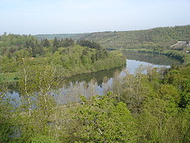 The Moselle river in Liverdun | |
 Coat of arms | |
 Liverdun  Liverdun | |
Coordinates:  48°44′59″N 6°03′44″E / 48.7497°N 6.0623°E / 48.7497; 6.0623Coordinates: 48°44′59″N 6°03′44″E / 48.7497°N 6.0623°E / 48.7497; 6.0623 48°44′59″N 6°03′44″E / 48.7497°N 6.0623°E / 48.7497; 6.0623Coordinates: 48°44′59″N 6°03′44″E / 48.7497°N 6.0623°E / 48.7497; 6.0623 | |
| Country | France |
| Region | Grand Est |
| Department | Meurthe-et-Moselle |
| Arrondissement | Toul |
| Canton | Le Nord-Toulois |
| Intercommunality | Bassin de Pompey |
| Area 1 | 25.25 km2 (9.75 sq mi) |
| Population (Jan. 2018)[1] | 5,976 |
| • Density | 240/km2 (610/sq mi) |
| Time zone | UTC+01:00 (CET) |
| • Summer (DST) | UTC+02:00 (CEST) |
| INSEE/Postal code | 54318 /54460 |
| Elevation | 203–325 m (666–1,066 ft) (avg. 204 m or 669 ft) |
| 1 French Land Register data, which excludes lakes, ponds, glaciers > 1 km2 (0.386 sq mi or 247 acres) and river estuaries. | |

Liverdun is a commune in the Meurthe-et-Moselle department in north-eastern France.
See also[]
References[]
- ^ "Populations légales 2018". INSEE. 28 December 2020.
| Wikimedia Commons has media related to Liverdun. |
show
| |
|---|---|
|
This Meurthe-et-Moselle geographical article is a stub. You can help Wikipedia by . |
- v
- t
Retrieved from ""
Categories:
- Communes of Meurthe-et-Moselle
- Meurthe-et-Moselle geography stubs
Hidden categories:
- Articles with short description
- Short description is different from Wikidata
- Infobox mapframe without OSM relation ID on Wikidata
- Coordinates on Wikidata
- Pages using infobox settlement with image map1 but not image map
- Commons category link from Wikidata
- Articles with VIAF identifiers
- Articles with BNF identifiers
- Articles with LCCN identifiers
- Articles with WORLDCATID identifiers
- All stub articles
- Pages using the Kartographer extension