Longlaville
Longlaville | |
|---|---|
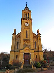 St. Laurentius' church | |
 Coat of arms | |
show Location of Longlaville | |
 Longlaville | |
| Coordinates: 49°32′06″N 5°47′57″E / 49.535°N 5.7992°ECoordinates: 49°32′06″N 5°47′57″E / 49.535°N 5.7992°E | |
| Country | France |
| Region | Grand Est |
| Department | Meurthe-et-Moselle |
| Arrondissement | Briey |
| Canton | Villerupt |
| Intercommunality | |
| Government | |
| • Mayor (2020–2026) | Hamdi Toudma |
| Area 1 | 3.17 km2 (1.22 sq mi) |
| Population (Jan. 2018)[1] | 2,363 |
| • Density | 750/km2 (1,900/sq mi) |
| Time zone | UTC+01:00 (CET) |
| • Summer (DST) | UTC+02:00 (CEST) |
| INSEE/Postal code | 54321 /54810 |
| Elevation | 255–391 m (837–1,283 ft) (avg. 248 m or 814 ft) |
| 1 French Land Register data, which excludes lakes, ponds, glaciers > 1 km2 (0.386 sq mi or 247 acres) and river estuaries. | |


Longlaville (French pronunciation: [lɔ̃lavil]; German: Longsdorf; Luxembourgish: Longsduerf) is a commune in the Meurthe-et-Moselle department in north-eastern France.
See also[]
References[]
- ^ "Populations légales 2018". INSEE. 28 December 2020.
| Wikimedia Commons has media related to Longlaville. |
| show Authority control |
|---|
This Meurthe-et-Moselle geographical article is a stub. You can help Wikipedia by . |
Categories:
- Communes of Meurthe-et-Moselle
- Meurthe-et-Moselle geography stubs