Malavillers
Malavillers | |
|---|---|
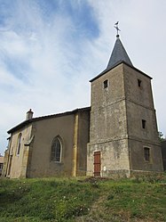 The church in Malavillers | |
 Coat of arms | |
show Location of Malavillers | |
 Malavillers | |
| Coordinates: 49°21′25″N 5°52′13″E / 49.3569°N 5.8703°ECoordinates: 49°21′25″N 5°52′13″E / 49.3569°N 5.8703°E | |
| Country | France |
| Region | Grand Est |
| Department | Meurthe-et-Moselle |
| Arrondissement | Briey |
| Canton | Pays de Briey |
| Intercommunality | Cœur du Pays-Haut |
| Government | |
| • Mayor (2008–2014) | Jean Onyszczuk |
| Area 1 | 4.37 km2 (1.69 sq mi) |
| Population (Jan. 2018)[1] | 129 |
| • Density | 30/km2 (76/sq mi) |
| Time zone | UTC+01:00 (CET) |
| • Summer (DST) | UTC+02:00 (CEST) |
| INSEE/Postal code | 54337 /54560 |
| Elevation | 313–379 m (1,027–1,243 ft) (avg. 385 m or 1,263 ft) |
| 1 French Land Register data, which excludes lakes, ponds, glaciers > 1 km2 (0.386 sq mi or 247 acres) and river estuaries. | |


Malavillers is a commune in the Meurthe-et-Moselle department in north-eastern France.
See also[]
References[]
- ^ "Populations légales 2018". INSEE. 28 December 2020.
| Wikimedia Commons has media related to Malavillers. |
| show Authority control |
|---|
This Meurthe-et-Moselle geographical article is a stub. You can help Wikipedia by . |
Categories:
- Communes of Meurthe-et-Moselle
- Meurthe-et-Moselle geography stubs