Martillac
Martillac | |
|---|---|
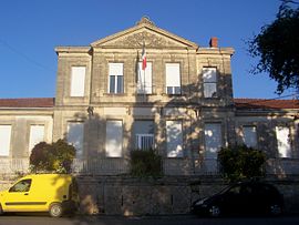 The town hall in Martillac | |
 Coat of arms | |
show Location of Martillac | |
 Martillac | |
| Coordinates: 44°42′51″N 0°32′32″W / 44.7142°N 0.5422°WCoordinates: 44°42′51″N 0°32′32″W / 44.7142°N 0.5422°W | |
| Country | France |
| Region | Nouvelle-Aquitaine |
| Department | Gironde |
| Arrondissement | Bordeaux |
| Canton | La Brède |
| Intercommunality | Montesquieu |
| Government | |
| • Mayor (2020–2026) | Dominique Claverie[1] |
| Area 1 | 17.09 km2 (6.60 sq mi) |
| Population (Jan. 2018)[2] | 3,187 |
| • Density | 190/km2 (480/sq mi) |
| Time zone | UTC+01:00 (CET) |
| • Summer (DST) | UTC+02:00 (CEST) |
| INSEE/Postal code | 33274 /33650 |
| Elevation | 8–59 m (26–194 ft) (avg. 45 m or 148 ft) |
| 1 French Land Register data, which excludes lakes, ponds, glaciers > 1 km2 (0.386 sq mi or 247 acres) and river estuaries. | |


Martillac (French pronunciation: [maʁtijak]; Occitan: Martilhac) is a commune in the Gironde department in Nouvelle-Aquitaine in southwestern France.
Population[]
| Year | Pop. | ±% |
|---|---|---|
| 1962 | 877 | — |
| 1968 | 965 | +10.0% |
| 1975 | 1,090 | +13.0% |
| 1982 | 1,309 | +20.1% |
| 1990 | 1,652 | +26.2% |
| 1999 | 2,020 | +22.3% |
| 2008 | 2,331 | +15.4% |
See also[]
References[]
- ^ "Répertoire national des élus: les maires". data.gouv.fr, Plateforme ouverte des données publiques françaises (in French). 2 December 2020.
- ^ "Populations légales 2018". INSEE. 28 December 2020.
| Wikimedia Commons has media related to Martillac. |
This Gironde geographical article is a stub. You can help Wikipedia by . |
Categories:
- Communes of Gironde
- Gironde geography stubs