Ozerailles
Ozerailles | |
|---|---|
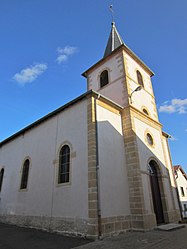 The church in Ozerailles | |
 Coat of arms | |
show Location of Ozerailles | |
 Ozerailles | |
| Coordinates: 49°13′53″N 5°50′29″E / 49.2314°N 5.8414°ECoordinates: 49°13′53″N 5°50′29″E / 49.2314°N 5.8414°E | |
| Country | France |
| Region | Grand Est |
| Department | Meurthe-et-Moselle |
| Arrondissement | Briey |
| Canton | Pays de Briey |
| Intercommunality | Orne Lorraine Confluences |
| Government | |
| • Mayor (2020–2026) | Robert Lefèvre |
| Area 1 | 6.32 km2 (2.44 sq mi) |
| Population (Jan. 2018)[1] | 151 |
| • Density | 24/km2 (62/sq mi) |
| Time zone | UTC+01:00 (CET) |
| • Summer (DST) | UTC+02:00 (CEST) |
| INSEE/Postal code | 54413 /54150 |
| Elevation | 202–236 m (663–774 ft) (avg. 212 m or 696 ft) |
| 1 French Land Register data, which excludes lakes, ponds, glaciers > 1 km2 (0.386 sq mi or 247 acres) and river estuaries. | |


Ozerailles (French pronunciation: [ozʁaj]) is a commune in the Meurthe-et-Moselle department in north-eastern France.
See also[]
References[]
- ^ "Populations légales 2018". INSEE. 28 December 2020.
| Wikimedia Commons has media related to Ozerailles. |
| show Authority control |
|---|
This Meurthe-et-Moselle geographical article is a stub. You can help Wikipedia by . |
Categories:
- Communes of Meurthe-et-Moselle
- Meurthe-et-Moselle geography stubs