Parempuyre
Parempuyre | |
|---|---|
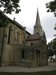 The church in Parempuyre | |
 Coat of arms | |
show Location of Parempuyre | |
 Parempuyre | |
| Coordinates: 44°57′00″N 0°36′14″W / 44.95°N 0.6039°WCoordinates: 44°57′00″N 0°36′14″W / 44.95°N 0.6039°W | |
| Country | France |
| Region | Nouvelle-Aquitaine |
| Department | Gironde |
| Arrondissement | Bordeaux |
| Canton | Les Portes du Médoc |
| Intercommunality | Bordeaux Métropole |
| Government | |
| • Mayor (2020–2026) | Béatrice De François |
| Area 1 | 21.8 km2 (8.4 sq mi) |
| Population (Jan. 2018)[1] | 8,963 |
| • Density | 410/km2 (1,100/sq mi) |
| Time zone | UTC+01:00 (CET) |
| • Summer (DST) | UTC+02:00 (CEST) |
| INSEE/Postal code | 33312 /33290 |
| Elevation | 0–15 m (0–49 ft) (avg. 7 m or 23 ft) |
| 1 French Land Register data, which excludes lakes, ponds, glaciers > 1 km2 (0.386 sq mi or 247 acres) and river estuaries. | |


Parempuyre (French pronunciation: [paʁɑ̃pɥiʁ]; Occitan: Parampuira) is a commune in the Gironde department in Nouvelle-Aquitaine in southwestern France.
Population[]
| Year | Pop. | ±% |
|---|---|---|
| 1962 | 1,166 | — |
| 1968 | 1,670 | +43.2% |
| 1975 | 2,148 | +28.6% |
| 1982 | 3,541 | +64.9% |
| 1990 | 5,481 | +54.8% |
| 1999 | 6,613 | +20.7% |
| 2008 | 7,409 | +12.0% |
See also[]
References[]
- ^ "Populations légales 2018". INSEE. 28 December 2020.
| Wikimedia Commons has media related to Parempuyre. |

This Gironde geographical article is a stub. You can help Wikipedia by . |
Categories:
- Communes of Gironde
- Gironde geography stubs