Puisseguin
Puisseguin | |
|---|---|
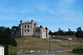 Chateau of Monbadon | |
 Coat of arms | |
show Location of Puisseguin | |
 Puisseguin | |
| Coordinates: 44°55′28″N 0°04′19″W / 44.9244°N 0.0719°WCoordinates: 44°55′28″N 0°04′19″W / 44.9244°N 0.0719°W | |
| Country | France |
| Region | Nouvelle-Aquitaine |
| Department | Gironde |
| Arrondissement | Libourne |
| Canton | Le Nord-Libournais |
| Intercommunality | Grand Saint-Émilionnais |
| Government | |
| • Mayor (2020–2026) | Jean, Michel Pasquon |
| Area 1 | 17.25 km2 (6.66 sq mi) |
| Population (Jan. 2018)[1] | 840 |
| • Density | 49/km2 (130/sq mi) |
| Time zone | UTC+01:00 (CET) |
| • Summer (DST) | UTC+02:00 (CEST) |
| INSEE/Postal code | 33342 /33570 |
| Elevation | 38–108 m (125–354 ft) (avg. 83 m or 272 ft) |
| 1 French Land Register data, which excludes lakes, ponds, glaciers > 1 km2 (0.386 sq mi or 247 acres) and river estuaries. | |


Puisseguin (French pronunciation: [pɥisɡɛ̃]; Occitan: Puègseguin) is a commune in the Gironde department in Nouvelle-Aquitaine in southwestern France. It is around 15 km east of Libourne.
In October 2015, 43 people died in a crash between a bus and a lorry.[2]
Geography[]
Located in the .
Bordering municipalities[]
The neighboring towns are Lussac in the north, Tayac in the extreme north-east for about 250 meters, Saint-Cibard to the East, Saint-Philippe-d'Aiguille at the South-East, Saint-Genès-de-Castillon at the South and Montagne in the west.
Population[]
| Year | Pop. | ±% |
|---|---|---|
| 1962 | 1,209 | — |
| 1968 | 1,215 | +0.5% |
| 1975 | 1,165 | −4.1% |
| 1982 | 1,107 | −5.0% |
| 1990 | 1,038 | −6.2% |
| 1999 | 924 | −11.0% |
| 2008 | 880 | −4.8% |
| 2012 | 861 | −2.2% |
See also[]
References[]
- ^ "Populations légales 2018". INSEE. 28 December 2020.
- ^ https://www.bbc.com/news/world-europe-34613637
| Wikimedia Commons has media related to Puisseguin. |
This Gironde geographical article is a stub. You can help Wikipedia by . |
Categories:
- Communes of Gironde
- Gironde geography stubs