Saint-Laurent-du-Plan
Saint-Laurent-du-Plan | |
|---|---|
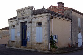 Town hall | |
show Location of Saint-Laurent-du-Plan | |
 Saint-Laurent-du-Plan | |
| Coordinates: 44°37′29″N 0°07′01″W / 44.6247°N 0.1169°WCoordinates: 44°37′29″N 0°07′01″W / 44.6247°N 0.1169°W | |
| Country | France |
| Region | Nouvelle-Aquitaine |
| Department | Gironde |
| Arrondissement | Langon |
| Canton | L'Entre-Deux-Mers |
| Government | |
| • Mayor (2020–2026) | Franck Boulin[1] |
| Area 1 | 2.39 km2 (0.92 sq mi) |
| Population (Jan. 2018)[2] | 88 |
| • Density | 37/km2 (95/sq mi) |
| Time zone | UTC+01:00 (CET) |
| • Summer (DST) | UTC+02:00 (CEST) |
| INSEE/Postal code | 33428 /33190 |
| Elevation | 19–82 m (62–269 ft) (avg. 53 m or 174 ft) |
| 1 French Land Register data, which excludes lakes, ponds, glaciers > 1 km2 (0.386 sq mi or 247 acres) and river estuaries. | |


Saint-Laurent-du-Plan is a commune in the Gironde department in Nouvelle-Aquitaine in southwestern France.
Population[]
| Year | Pop. | ±% |
|---|---|---|
| 1962 | 56 | — |
| 1968 | 80 | +42.9% |
| 1975 | 75 | −6.2% |
| 1982 | 74 | −1.3% |
| 1990 | 79 | +6.8% |
| 1999 | 71 | −10.1% |
| 2008 | 84 | +18.3% |
See also[]
References[]
- ^ "Répertoire national des élus: les maires". data.gouv.fr, Plateforme ouverte des données publiques françaises (in French). 2 December 2020.
- ^ "Populations légales 2018". INSEE. 28 December 2020.
| Wikimedia Commons has media related to Saint-Laurent-du-Plan. |
| show Authority control |
|---|
This Gironde geographical article is a stub. You can help Wikipedia by . |
Categories:
- Communes of Gironde
- Gironde geography stubs