Saint-Loubert
Saint-Loubert | |
|---|---|
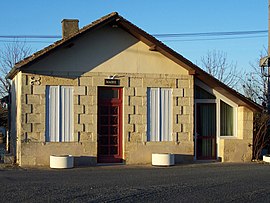 Town hall | |
show Location of Saint-Loubert | |
 Saint-Loubert | |
| Coordinates: 44°33′37″N 0°10′28″W / 44.5603°N 0.1744°WCoordinates: 44°33′37″N 0°10′28″W / 44.5603°N 0.1744°W | |
| Country | France |
| Region | Nouvelle-Aquitaine |
| Department | Gironde |
| Arrondissement | Langon |
| Canton | Le Sud-Gironde |
| Government | |
| • Mayor (2020–2026) | Alain Clech[1] |
| Area 1 | 2.11 km2 (0.81 sq mi) |
| Population (Jan. 2018)[2] | 231 |
| • Density | 110/km2 (280/sq mi) |
| Time zone | UTC+01:00 (CET) |
| • Summer (DST) | UTC+02:00 (CEST) |
| INSEE/Postal code | 33432 /33210 |
| Elevation | 10–46 m (33–151 ft) (avg. 41 m or 135 ft) |
| 1 French Land Register data, which excludes lakes, ponds, glaciers > 1 km2 (0.386 sq mi or 247 acres) and river estuaries. | |


Saint-Loubert is a commune in the Gironde department in Nouvelle-Aquitaine in southwestern France.
Population[]
| Year | Pop. | ±% |
|---|---|---|
| 1962 | 123 | — |
| 1968 | 126 | +2.4% |
| 1975 | 122 | −3.2% |
| 1982 | 114 | −6.6% |
| 1990 | 103 | −9.6% |
| 1999 | 129 | +25.2% |
| 2008 | 175 | +35.7% |
See also[]
References[]
- ^ "Répertoire national des élus: les maires". data.gouv.fr, Plateforme ouverte des données publiques françaises (in French). 2 December 2020.
- ^ "Populations légales 2018". INSEE. 28 December 2020.
| Wikimedia Commons has media related to Saint-Loubert. |
This Gironde geographical article is a stub. You can help Wikipedia by . |
Categories:
- Communes of Gironde
- Gironde geography stubs