Saint-Maixant, Gironde
Saint-Maixant | |
|---|---|
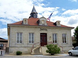 Town hall | |
 Coat of arms | |
show Location of Saint-Maixant | |
 Saint-Maixant | |
| Coordinates: 44°34′47″N 0°15′35″W / 44.5797°N 0.2597°WCoordinates: 44°34′47″N 0°15′35″W / 44.5797°N 0.2597°W | |
| Country | France |
| Region | Nouvelle-Aquitaine |
| Department | Gironde |
| Arrondissement | Langon |
| Canton | L'Entre-Deux-Mers |
| Government | |
| • Mayor (2020–2026) | Alain Bernardet[1] |
| Area 1 | 7.68 km2 (2.97 sq mi) |
| Population (Jan. 2018)[2] | 1,945 |
| • Density | 250/km2 (660/sq mi) |
| Time zone | UTC+01:00 (CET) |
| • Summer (DST) | UTC+02:00 (CEST) |
| INSEE/Postal code | 33438 /33490 |
| Elevation | 0–98 m (0–322 ft) (avg. 20 m or 66 ft) |
| 1 French Land Register data, which excludes lakes, ponds, glaciers > 1 km2 (0.386 sq mi or 247 acres) and river estuaries. | |


Saint-Maixant is a commune in the Gironde department in Nouvelle-Aquitaine in southwestern France.
Population[]
| Year | Pop. | ±% |
|---|---|---|
| 1962 | 830 | — |
| 1968 | 925 | +11.4% |
| 1975 | 1,018 | +10.1% |
| 1982 | 1,203 | +18.2% |
| 1990 | 1,349 | +12.1% |
| 1999 | 1,277 | −5.3% |
| 2008 | 1,388 | +8.7% |
See also[]
References[]
- ^ "Répertoire national des élus: les maires". data.gouv.fr, Plateforme ouverte des données publiques françaises (in French). 2 December 2020.
- ^ "Populations légales 2018". INSEE. 28 December 2020.
| Wikimedia Commons has media related to Saint-Maixant (Gironde). |
| show Authority control |
|---|
This Gironde geographical article is a stub. You can help Wikipedia by . |
Categories:
- Communes of Gironde
- Gironde geography stubs