Saint-Mard, Meurthe-et-Moselle
Saint-Mard | |
|---|---|
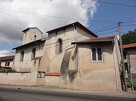 The church in Saint-Mard | |
 Coat of arms | |
show Location of Saint-Mard | |
 Saint-Mard | |
| Coordinates: 48°30′23″N 6°18′23″E / 48.5064°N 6.3064°ECoordinates: 48°30′23″N 6°18′23″E / 48.5064°N 6.3064°E | |
| Country | France |
| Region | Grand Est |
| Department | Meurthe-et-Moselle |
| Arrondissement | Lunéville |
| Canton | Lunéville-2 |
| Intercommunality | Meurthe, Mortagne, Moselle |
| Government | |
| • Mayor (2020–2026) | Daniel Barthélémy |
| Area 1 | 2.95 km2 (1.14 sq mi) |
| Population (Jan. 2018)[1] | 91 |
| • Density | 31/km2 (80/sq mi) |
| Time zone | UTC+01:00 (CET) |
| • Summer (DST) | UTC+02:00 (CEST) |
| INSEE/Postal code | 54479 /54290 |
| Elevation | 237–346 m (778–1,135 ft) (avg. 250 m or 820 ft) |
| 1 French Land Register data, which excludes lakes, ponds, glaciers > 1 km2 (0.386 sq mi or 247 acres) and river estuaries. | |


Saint-Mard (French pronunciation: [sɛ̃ maʁ] (![]() listen)) is a commune in the Meurthe-et-Moselle department in north-eastern France.
listen)) is a commune in the Meurthe-et-Moselle department in north-eastern France.
See also[]
References[]
- ^ "Populations légales 2018". INSEE. 28 December 2020.
| Wikimedia Commons has media related to Saint-Mard (Meurthe-et-Moselle). |
| show Authority control |
|---|
This Meurthe-et-Moselle geographical article is a stub. You can help Wikipedia by . |
Categories:
- Communes of Meurthe-et-Moselle
- Meurthe-et-Moselle geography stubs