Saint-Savin, Gironde
Saint-Savin | |
|---|---|
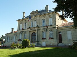 The town hall in Saint-Savin | |
 Coat of arms | |
show Location of Saint-Savin | |
 Saint-Savin | |
| Coordinates: 45°08′22″N 0°26′51″W / 45.1394°N 0.4475°WCoordinates: 45°08′22″N 0°26′51″W / 45.1394°N 0.4475°W | |
| Country | France |
| Region | Nouvelle-Aquitaine |
| Department | Gironde |
| Arrondissement | Blaye |
| Canton | Le Nord-Gironde |
| Intercommunality | Latitude Nord Gironde |
| Government | |
| • Mayor (2020–2026) | Alain Renard |
| Area 1 | 33.87 km2 (13.08 sq mi) |
| Population (Jan. 2018)[1] | 3,222 |
| • Density | 95/km2 (250/sq mi) |
| Time zone | UTC+01:00 (CET) |
| • Summer (DST) | UTC+02:00 (CEST) |
| INSEE/Postal code | 33473 /33920 |
| Elevation | 19–93 m (62–305 ft) (avg. 95 m or 312 ft) |
| 1 French Land Register data, which excludes lakes, ponds, glaciers > 1 km2 (0.386 sq mi or 247 acres) and river estuaries. | |


Saint-Savin (French pronunciation: [sɛ̃ savɛ̃]) is a commune in the Gironde department in Nouvelle-Aquitaine in southwestern France.
Population[]
|
|
See also[]
References[]
- ^ "Populations légales 2018". INSEE. 28 December 2020.
| Wikimedia Commons has media related to Saint-Savin (Gironde). |
This Gironde geographical article is a stub. You can help Wikipedia by . |
Categories:
- Communes of Gironde
- Gironde geography stubs