Saxon-Sion
Saxon-Sion | |
|---|---|
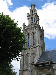 The church in Sion | |
 Coat of arms | |
show Location of Saxon-Sion | |
 Saxon-Sion | |
| Coordinates: 48°25′36″N 6°04′47″E / 48.4267°N 6.0797°ECoordinates: 48°25′36″N 6°04′47″E / 48.4267°N 6.0797°E | |
| Country | France |
| Region | Grand Est |
| Department | Meurthe-et-Moselle |
| Arrondissement | Nancy |
| Canton | Meine au Saintois |
| Intercommunality | CC Pays du Saintois |
| Government | |
| • Mayor (2020–2026) | Francine Parisot[1] |
| Area 1 | 6.25 km2 (2.41 sq mi) |
| Population (Jan. 2018)[2] | 107 |
| • Density | 17/km2 (44/sq mi) |
| Time zone | UTC+01:00 (CET) |
| • Summer (DST) | UTC+02:00 (CEST) |
| INSEE/Postal code | 54497 /54330 |
| Elevation | 302–528 m (991–1,732 ft) (avg. 480 m or 1,570 ft) |
| 1 French Land Register data, which excludes lakes, ponds, glaciers > 1 km2 (0.386 sq mi or 247 acres) and river estuaries. | |


Saxon-Sion is a commune in the Meurthe-et-Moselle department in north-eastern France. In it are located the villages of Saxon and Sion.
See also[]
References[]
- ^ "Répertoire national des élus: les maires". data.gouv.fr, Plateforme ouverte des données publiques françaises (in French). 2 December 2020.
- ^ "Populations légales 2018". INSEE. 28 December 2020.
| Wikimedia Commons has media related to Saxon-Sion. |
| show Authority control |
|---|
This Meurthe-et-Moselle geographical article is a stub. You can help Wikipedia by . |
Categories:
- Communes of Meurthe-et-Moselle
- Leuci
- Meurthe-et-Moselle geography stubs