Verdelais
Verdelais | |
|---|---|
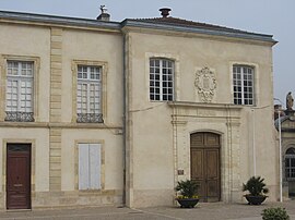 Town hall | |
show Location of Verdelais | |
 Verdelais | |
| Coordinates: 44°35′19″N 0°15′02″W / 44.5886°N 0.2506°WCoordinates: 44°35′19″N 0°15′02″W / 44.5886°N 0.2506°W | |
| Country | France |
| Region | Nouvelle-Aquitaine |
| Department | Gironde |
| Arrondissement | Langon |
| Canton | L'Entre-Deux-Mers |
| Intercommunality | Sud Gironde |
| Government | |
| • Mayor (2008–2014) | Philippe Mesnard |
| Area 1 | 4.75 km2 (1.83 sq mi) |
| Population (Jan. 2018)[1] | 1,026 |
| • Density | 220/km2 (560/sq mi) |
| Time zone | UTC+01:00 (CET) |
| • Summer (DST) | UTC+02:00 (CEST) |
| INSEE/Postal code | 33543 /33490 |
| Elevation | 2–103 m (6.6–337.9 ft) (avg. 70 m or 230 ft) |
| 1 French Land Register data, which excludes lakes, ponds, glaciers > 1 km2 (0.386 sq mi or 247 acres) and river estuaries. | |


Verdelais is a commune in the Gironde department in Nouvelle-Aquitaine in southwestern France.
Population[]
| Year | Pop. | ±% |
|---|---|---|
| 1962 | 846 | — |
| 1968 | 831 | −1.8% |
| 1975 | 923 | +11.1% |
| 1982 | 880 | −4.7% |
| 1990 | 869 | −1.2% |
| 1999 | 869 | +0.0% |
| 2008 | 898 | +3.3% |
See also[]
References[]
- ^ "Populations légales 2018". INSEE. 28 December 2020.
External links[]
| Wikimedia Commons has media related to Verdelais. |
| show Authority control |
|---|
This Gironde geographical article is a stub. You can help Wikipedia by . |
Categories:
- Communes of Gironde
- Gironde geography stubs