Aclou
From Wikipedia, the free encyclopedia
This article includes a list of references, related reading or external links, but its sources remain unclear because it lacks inline citations. Please help to improve this article by introducing more precise citations. (July 2016) (Learn how and when to remove this template message) |
Commune in Normandy, France
Aclou | |
|---|---|
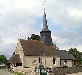 Church Saint-Rémi | |
 Aclou  Aclou | |
Coordinates:  49°10′16″N 0°42′18″E / 49.171°N 0.705°E / 49.171; 0.705Coordinates: 49°10′16″N 0°42′18″E / 49.171°N 0.705°E / 49.171; 0.705 49°10′16″N 0°42′18″E / 49.171°N 0.705°E / 49.171; 0.705Coordinates: 49°10′16″N 0°42′18″E / 49.171°N 0.705°E / 49.171; 0.705 | |
| Country | France |
| Region | Normandy |
| Department | Eure |
| Arrondissement | Bernay |
| Canton | Brionne |
| Intercommunality | |
| Government | |
| • Mayor (2020–2026) | Nicolas Seys |
| Area 1 | 3.7 km2 (1.4 sq mi) |
| Population (Jan. 2018)[1] | 325 |
| • Density | 88/km2 (230/sq mi) |
| Time zone | UTC+01:00 (CET) |
| • Summer (DST) | UTC+02:00 (CEST) |
| INSEE/Postal code | 27001 /27800 |
| Elevation | 57–155 m (187–509 ft) (avg. 142 m or 466 ft) |
| 1 French Land Register data, which excludes lakes, ponds, glaciers > 1 km2 (0.386 sq mi or 247 acres) and river estuaries. | |

Aclou (French pronunciation: [aklu]) is a commune in the Eure department in Normandie in northern France.
Population[]
| Year | Pop. | ±% |
|---|---|---|
| 2004 | 234 | — |
| 2006 | 234 | +0.0% |
| 2007 | 244 | +4.3% |
| 2008 | 255 | +4.5% |
| 2009 | 266 | +4.3% |
| 2010 | 266 | +0.0% |
| 2011 | 271 | +1.9% |
| 2012 | 281 | +3.7% |
| 2013 | 290 | +3.2% |
| 2014 | 300 | +3.4% |
| 2015 | 310 | +3.3% |
| 2016 | 322 | +3.9% |
See also[]
- Communes of the Eure department
References[]
- ^ "Populations légales 2018". INSEE. 28 December 2020.
| Wikimedia Commons has media related to Aclou. |
show
Communes of the Eure department | |
|---|---|
|
This Eure geographical article is a stub. You can help Wikipedia by . |
- v
- t
Retrieved from ""
Categories:
- Communes of Eure
- Eure geography stubs
Hidden categories:
- Articles lacking in-text citations from July 2016
- All articles lacking in-text citations
- Articles with short description
- Short description is different from Wikidata
- Infobox mapframe without OSM relation ID on Wikidata
- Coordinates on Wikidata
- Pages using infobox settlement with image map1 but not image map
- Commons category link is on Wikidata
- Articles with BNF identifiers
- All stub articles
- Pages using the Kartographer extension