Aizier
Aizier | |
|---|---|
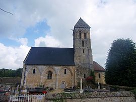 The church in Aizier | |
show Location of Aizier | |
 Aizier | |
| Coordinates: 49°25′52″N 0°37′38″E / 49.4311°N 0.6272°ECoordinates: 49°25′52″N 0°37′38″E / 49.4311°N 0.6272°E | |
| Country | France |
| Region | Normandy |
| Department | Eure |
| Arrondissement | Bernay |
| Canton | Bourg-Achard |
| Intercommunality | |
| Government | |
| • Mayor (2020–2026) | Arnaud Maupoint |
| Area 1 | 2.36 km2 (0.91 sq mi) |
| Population (Jan. 2018)[1] | 143 |
| • Density | 61/km2 (160/sq mi) |
| Time zone | UTC+01:00 (CET) |
| • Summer (DST) | UTC+02:00 (CEST) |
| INSEE/Postal code | 27006 /27500 |
| Elevation | 0–117 m (0–384 ft) (avg. 27 m or 89 ft) |
| 1 French Land Register data, which excludes lakes, ponds, glaciers > 1 km2 (0.386 sq mi or 247 acres) and river estuaries. | |


Aizier (French pronunciation: [ɛzje]) is a commune in the Eure department in Normandie in northern France.
Population[]
| Year | Pop. | ±% |
|---|---|---|
| 2006 | 114 | — |
| 2007 | 112 | −1.8% |
| 2008 | 118 | +5.4% |
| 2009 | 123 | +4.2% |
| 2010 | 128 | +4.1% |
| 2011 | 132 | +3.1% |
| 2012 | 134 | +1.5% |
| 2013 | 133 | −0.7% |
| 2014 | 132 | −0.8% |
| 2015 | 131 | −0.8% |
| 2016 | 136 | +3.8% |
See also[]
- Communes of the Eure department
References[]
- ^ "Populations légales 2018". INSEE. 28 December 2020.
External links[]
| Wikimedia Commons has media related to Aizier. |
- Website of the Commune Aizier
- Country Risle Estuaire
- Normandy Tourism - Official Site C.R.T. Normandy
- Federation Regional Tourist Country Home
- Normandy Tour
- Normandie Qualité Tourisme
- Comité Départemental du Tourisme de l'Eure
- Eure 27 Normandy
- Office de Tourisme d'Evreux
| show Communes of the Eure department |
|---|
This Eure geographical article is a stub. You can help Wikipedia by . |
Categories:
- Communes of Eure
- Eure geography stubs