Bouchevilliers
Bouchevilliers | |
|---|---|
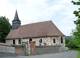 The church in Bouchevilliers | |
show Location of Bouchevilliers | |
 Bouchevilliers | |
| Coordinates: 49°24′14″N 1°42′56″E / 49.4039°N 1.7156°ECoordinates: 49°24′14″N 1°42′56″E / 49.4039°N 1.7156°E | |
| Country | France |
| Region | Normandy |
| Department | Eure |
| Arrondissement | Les Andelys |
| Canton | Romilly-sur-Andelle |
| Intercommunality | CC 4 rivières |
| Government | |
| • Mayor (2020–2026) | Emmanuel Broux[1] |
| Area 1 | 4.31 km2 (1.66 sq mi) |
| Population (Jan. 2018)[2] | 81 |
| • Density | 19/km2 (49/sq mi) |
| Time zone | UTC+01:00 (CET) |
| • Summer (DST) | UTC+02:00 (CEST) |
| INSEE/Postal code | 27098 /27150 |
| Elevation | 73–195 m (240–640 ft) (avg. 81 m or 266 ft) |
| 1 French Land Register data, which excludes lakes, ponds, glaciers > 1 km2 (0.386 sq mi or 247 acres) and river estuaries. | |


Bouchevilliers is a commune in the Eure department in Normandy in north-western France.
Population[]
|
|
See also[]
- Communes of the Eure department
References[]
- ^ "Répertoire national des élus: les maires". data.gouv.fr, Plateforme ouverte des données publiques françaises (in French). 2 December 2020.
- ^ "Populations légales 2018". INSEE. 28 December 2020.
| Wikimedia Commons has media related to Bouchevilliers. |
| show Communes of the Eure department |
|---|
This Eure geographical article is a stub. You can help Wikipedia by . |
Categories:
- Communes of Eure
- Eure geography stubs