Bourg-Achard
From Wikipedia, the free encyclopedia
Commune in Normandy, France
Bourg-Achard | |
|---|---|
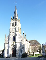 The church in Bourg-Achard | |
 Coat of arms | |
 Bourg-Achard  Bourg-Achard | |
Coordinates:  49°21′22″N 0°49′06″E / 49.3561°N 0.8183°E / 49.3561; 0.8183Coordinates: 49°21′22″N 0°49′06″E / 49.3561°N 0.8183°E / 49.3561; 0.8183 49°21′22″N 0°49′06″E / 49.3561°N 0.8183°E / 49.3561; 0.8183Coordinates: 49°21′22″N 0°49′06″E / 49.3561°N 0.8183°E / 49.3561; 0.8183 | |
| Country | France |
| Region | Normandy |
| Department | Eure |
| Arrondissement | Bernay |
| Canton | Bourg-Achard |
| Government | |
| • Mayor (2020–2026) | Josette Simon |
| Area 1 | 12.32 km2 (4.76 sq mi) |
| Population (Jan. 2018)[1] | 3,945 |
| • Density | 320/km2 (830/sq mi) |
| Time zone | UTC+01:00 (CET) |
| • Summer (DST) | UTC+02:00 (CEST) |
| INSEE/Postal code | 27103 /27310 |
| Elevation | 94–144 m (308–472 ft) (avg. 142 m or 466 ft) |
| 1 French Land Register data, which excludes lakes, ponds, glaciers > 1 km2 (0.386 sq mi or 247 acres) and river estuaries. | |

Bourg-Achard (French pronunciation: [buʁ aʃaʁ]) is a commune in the Eure department in the Normandy region in northern France.
Contents
Geography[]
It is situated in the Roumois region of Normandy and sits at the junction of the motorways A13 (Paris-Caen) and A28 (Rouen-Le Mans), 150 km (93 mi) from Paris.
Population[]
| Year | Pop. | ±% |
|---|---|---|
| 1962 | 1,392 | — |
| 1968 | 1,564 | +12.4% |
| 1975 | 1,793 | +14.6% |
| 1982 | 2,009 | +12.0% |
| 1990 | 2,255 | +12.2% |
| 1999 | 2,517 | +11.6% |
| 2008 | 2,885 | +14.6% |
See also[]
- Communes of the Eure department
References[]
- ^ "Populations légales 2018". INSEE. 28 December 2020.
| Wikimedia Commons has media related to Bourg-Achard. |
show
Communes of the Eure department | |
|---|---|
|
| show Authority control | |
|---|---|
| General |
|
| National libraries | |
This Eure geographical article is a stub. You can help Wikipedia by . |
- v
- t
Retrieved from ""
Categories:
- Communes of Eure
- Eure geography stubs
Hidden categories:
- Articles with short description
- Short description is different from Wikidata
- Infobox mapframe without OSM relation ID on Wikidata
- Coordinates on Wikidata
- Pages using infobox settlement with image map1 but not image map
- Commons category link is on Wikidata
- Articles with VIAF identifiers
- Articles with BNF identifiers
- Articles with WorldCat-VIAF identifiers
- All stub articles
- Pages using the Kartographer extension