Bresson, Isère
show This article may be expanded with text translated from the corresponding article in French. (March 2019) Click [show] for important translation instructions. |
Bresson | |
|---|---|
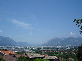 View towards Grenoble | |
show Location of Bresson | |
 Bresson | |
| Coordinates: 45°08′23″N 5°44′53″E / 45.1396°N 05.7480°ECoordinates: 45°08′23″N 5°44′53″E / 45.1396°N 05.7480°E | |
| Country | France |
| Region | Auvergne-Rhône-Alpes |
| Department | Isère |
| Arrondissement | Grenoble |
| Canton | Échirolles |
| Intercommunality | Grenoble-Alpes Métropole |
| Government | |
| • Mayor (2014-2020) | Michel Rebuffet |
| Area 1 | 2.80 km2 (1.08 sq mi) |
| Population (Jan. 2018)[1] | 677 |
| • Density | 240/km2 (630/sq mi) |
| Time zone | UTC+01:00 (CET) |
| • Summer (DST) | UTC+02:00 (CEST) |
| INSEE/Postal code | 38057 /38320 |
| Elevation | 228–533 m (748–1,749 ft) |
| 1 French Land Register data, which excludes lakes, ponds, glaciers > 1 km2 (0.386 sq mi or 247 acres) and river estuaries. | |


Bresson is a commune in the Isère department in southeastern France.
Population[]
| Year | Pop. | ±% |
|---|---|---|
| 1793 | 248 | — |
| 1800 | 255 | +2.8% |
| 1821 | 263 | +3.1% |
| 1831 | 288 | +9.5% |
| 1841 | 295 | +2.4% |
| 1851 | 265 | −10.2% |
| 1861 | 250 | −5.7% |
| 1872 | 241 | −3.6% |
| 1881 | 242 | +0.4% |
| 1891 | 228 | −5.8% |
| 1901 | 215 | −5.7% |
| 1911 | 184 | −14.4% |
| 1921 | 160 | −13.0% |
| 1931 | 154 | −3.7% |
| 1946 | 148 | −3.9% |
| 1954 | 202 | +36.5% |
| 1962 | 250 | +23.8% |
| 1968 | 309 | +23.6% |
| 1975 | 359 | +16.2% |
| 1982 | 474 | +32.0% |
| 1990 | 753 | +58.9% |
| 1999 | 739 | −1.9% |
| 2010 | 692 | −6.4% |
See also[]
- Urban unit of Grenoble
- Communes of the Isère department
References[]
- ^ "Populations légales 2018". INSEE. 28 December 2020.
| Wikimedia Commons has media related to Bresson. |
This Isère geographical article is a stub. You can help Wikipedia by . |
Categories:
- Communes of Isère
- Isère geography stubs