Moras
Moras | |
|---|---|
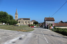 The church of Moras and its surroundings | |
show Location of Moras | |
 Moras | |
| Coordinates: 45°41′18″N 5°15′32″E / 45.6883°N 5.2589°ECoordinates: 45°41′18″N 5°15′32″E / 45.6883°N 5.2589°E | |
| Country | France |
| Region | Auvergne-Rhône-Alpes |
| Department | Isère |
| Arrondissement | La Tour-du-Pin |
| Canton | Charvieu-Chavagneux |
| Government | |
| • Mayor (2014–2020) | Bernard Bourgier |
| Area 1 | 8.32 km2 (3.21 sq mi) |
| Population (Jan. 2018)[1] | 515 |
| • Density | 62/km2 (160/sq mi) |
| Time zone | UTC+01:00 (CET) |
| • Summer (DST) | UTC+02:00 (CEST) |
| INSEE/Postal code | 38260 /38460 |
| Elevation | 275–436 m (902–1,430 ft) (avg. 345 m or 1,132 ft) |
| 1 French Land Register data, which excludes lakes, ponds, glaciers > 1 km2 (0.386 sq mi or 247 acres) and river estuaries. | |


show This article may be expanded with text translated from the corresponding article in French. (December 2009) Click [show] for important translation instructions. |
Moras is a commune in the Isère department in southeastern France.
Population[]
| Year | Pop. | ±% |
|---|---|---|
| 1793 | 314 | — |
| 1806 | 338 | +7.6% |
| 1821 | 301 | −10.9% |
| 1831 | 372 | +23.6% |
| 1841 | 382 | +2.7% |
| 1851 | 413 | +8.1% |
| 1861 | 380 | −8.0% |
| 1872 | 356 | −6.3% |
| 1881 | 302 | −15.2% |
| 1891 | 295 | −2.3% |
| 1901 | 282 | −4.4% |
| 1911 | 254 | −9.9% |
| 1921 | 208 | −18.1% |
| 1931 | 214 | +2.9% |
| 1946 | 215 | +0.5% |
| 1954 | 203 | −5.6% |
| 1962 | 190 | −6.4% |
| 1968 | 167 | −12.1% |
| 1975 | 188 | +12.6% |
| 1982 | 359 | +91.0% |
| 1990 | 339 | −5.6% |
| 1999 | 418 | +23.3% |
| 2006 | 457 | +9.3% |
| 2011 | 479 | +4.8% |
See also[]
References[]
- ^ "Populations légales 2018". INSEE. 28 December 2020.
| Wikimedia Commons has media related to Moras. |
This Isère geographical article is a stub. You can help Wikipedia by . |
Categories:
- Communes of Isère
- Isère geography stubs