Merlas
Merlas | |
|---|---|
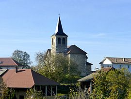 The church of Saint-Ferréol | |
show Location of Merlas | |
 Merlas | |
| Coordinates: 45°26′44″N 5°39′48″E / 45.4456°N 5.6633°ECoordinates: 45°26′44″N 5°39′48″E / 45.4456°N 5.6633°E | |
| Country | France |
| Region | Auvergne-Rhône-Alpes |
| Department | Isère |
| Arrondissement | La Tour-du-Pin |
| Canton | Chartreuse-Guiers |
| Intercommunality | CA Pays Voironnais |
| Government | |
| • Mayor (2020–2026) | Denis Grandperrin |
| Area 1 | 15.64 km2 (6.04 sq mi) |
| Population (Jan. 2018)[1] | 483 |
| • Density | 31/km2 (80/sq mi) |
| Time zone | UTC+01:00 (CET) |
| • Summer (DST) | UTC+02:00 (CEST) |
| INSEE/Postal code | 38228 /38620 |
| Elevation | 400–925 m (1,312–3,035 ft) (avg. 600 m or 2,000 ft) |
| 1 French Land Register data, which excludes lakes, ponds, glaciers > 1 km2 (0.386 sq mi or 247 acres) and river estuaries. | |


show This article may be expanded with text translated from the corresponding article in French. (December 2009) Click [show] for important translation instructions. |
Merlas (French pronunciation: [mɛʁla]) is a commune in the Isère department in southeastern France.
Population[]

The ruins of the Saint-Sixte castle, in the town of Merlas
| Year | Pop. | ±% |
|---|---|---|
| 1793 | 934 | — |
| 1806 | 1,071 | +14.7% |
| 1821 | 1,011 | −5.6% |
| 1831 | 1,235 | +22.2% |
| 1841 | 1,144 | −7.4% |
| 1851 | 1,128 | −1.4% |
| 1861 | 980 | −13.1% |
| 1872 | 970 | −1.0% |
| 1881 | 921 | −5.1% |
| 1891 | 907 | −1.5% |
| 1901 | 834 | −8.0% |
| 1911 | 709 | −15.0% |
| 1921 | 578 | −18.5% |
| 1931 | 533 | −7.8% |
| 1946 | 500 | −6.2% |
| 1954 | 491 | −1.8% |
| 1962 | 424 | −13.6% |
| 1968 | 373 | −12.0% |
| 1975 | 290 | −22.3% |
| 1982 | 320 | +10.3% |
| 1990 | 381 | +19.1% |
| 1999 | 405 | +6.3% |
| 2005 | 458 | +13.1% |
| 2011 | 496 | +8.3% |
See also[]
References[]
- ^ "Populations légales 2018". INSEE. 28 December 2020.
| Wikimedia Commons has media related to Merlas. |
This Isère geographical article is a stub. You can help Wikipedia by . |
Categories:
- Communes of Isère
- Isère geography stubs