Moissieu-sur-Dolon
Moissieu-sur-Dolon | |
|---|---|
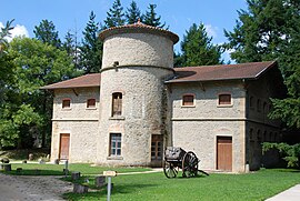 Dovecote | |
show Location of Moissieu-sur-Dolon | |
 Moissieu-sur-Dolon | |
| Coordinates: 45°23′13″N 4°59′19″E / 45.3869°N 4.9886°ECoordinates: 45°23′13″N 4°59′19″E / 45.3869°N 4.9886°E | |
| Country | France |
| Region | Auvergne-Rhône-Alpes |
| Department | Isère |
| Arrondissement | Vienne |
| Canton | Roussillon |
| Government | |
| • Mayor (2020–2026) | Gilbert Manin |
| Area 1 | 14.38 km2 (5.55 sq mi) |
| Population (Jan. 2018)[1] | 723 |
| • Density | 50/km2 (130/sq mi) |
| Time zone | UTC+01:00 (CET) |
| • Summer (DST) | UTC+02:00 (CEST) |
| INSEE/Postal code | 38240 /38270 |
| Elevation | 287–463 m (942–1,519 ft) (avg. 342 m or 1,122 ft) |
| 1 French Land Register data, which excludes lakes, ponds, glaciers > 1 km2 (0.386 sq mi or 247 acres) and river estuaries. | |


show This article may be expanded with text translated from the corresponding article in French. (December 2009) Click [show] for important translation instructions. |
Moissieu-sur-Dolon (French pronunciation: [mwasjø syʁ dɔlɔ̃]) is a commune in the Isère department in southeastern France.
Population[]
| Year | Pop. | ±% |
|---|---|---|
| 1793 | 487 | — |
| 1806 | 552 | +13.3% |
| 1821 | 635 | +15.0% |
| 1831 | 610 | −3.9% |
| 1841 | 605 | −0.8% |
| 1851 | 605 | +0.0% |
| 1861 | 651 | +7.6% |
| 1872 | 599 | −8.0% |
| 1881 | 566 | −5.5% |
| 1891 | 551 | −2.7% |
| 1901 | 560 | +1.6% |
| 1911 | 506 | −9.6% |
| 1921 | 445 | −12.1% |
| 1931 | 452 | +1.6% |
| 1946 | 387 | −14.4% |
| 1954 | 396 | +2.3% |
| 1962 | 387 | −2.3% |
| 1968 | 372 | −3.9% |
| 1975 | 369 | −0.8% |
| 1982 | 407 | +10.3% |
| 1990 | 481 | +18.2% |
| 1999 | 500 | +4.0% |
| 2006 | 675 | +35.0% |
| 2011 | 700 | +3.7% |
See also[]
References[]
- ^ "Populations légales 2018". INSEE. 28 December 2020.
| Wikimedia Commons has media related to Moissieu-sur-Dolon. |
This Isère geographical article is a stub. You can help Wikipedia by . |
Categories:
- Communes of Isère
- Isère geography stubs