Vénérieu
Vénérieu | |
|---|---|
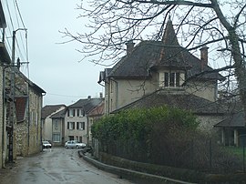 The centre of the village | |
Location of Vénérieu  | |
 Vénérieu | |
| Coordinates: 45°39′36″N 5°16′42″E / 45.66°N 5.2783°ECoordinates: 45°39′36″N 5°16′42″E / 45.66°N 5.2783°E | |
| Country | France |
| Region | Auvergne-Rhône-Alpes |
| Department | Isère |
| Arrondissement | La Tour-du-Pin |
| Canton | Charvieu-Chavagneux |
| Government | |
| • Mayor (2020–2026) | Christian Franzoi |
| Area 1 | 6 km2 (2 sq mi) |
| Population (Jan. 2018)[1] | 892 |
| • Density | 150/km2 (390/sq mi) |
| Time zone | UTC+01:00 (CET) |
| • Summer (DST) | UTC+02:00 (CEST) |
| INSEE/Postal code | 38532 /38460 |
| Elevation | 217–420 m (712–1,378 ft) (avg. 250 m or 820 ft) |
| 1 French Land Register data, which excludes lakes, ponds, glaciers > 1 km2 (0.386 sq mi or 247 acres) and river estuaries. | |


This article may be expanded with text translated from the corresponding article in French. (December 2009) Click [show] for important translation instructions.
|
Vénérieu (French pronunciation: [veneʁjø]) is a commune in the Isère department in southeastern France.
Population[]
| Year | Pop. | ±% |
|---|---|---|
| 1793 | 301 | — |
| 1806 | 314 | +4.3% |
| 1821 | 334 | +6.4% |
| 1831 | 331 | −0.9% |
| 1841 | 352 | +6.3% |
| 1851 | 422 | +19.9% |
| 1861 | 425 | +0.7% |
| 1872 | 450 | +5.9% |
| 1881 | 367 | −18.4% |
| 1891 | 420 | +14.4% |
| 1901 | 420 | +0.0% |
| 1911 | 412 | −1.9% |
| 1921 | 337 | −18.2% |
| 1931 | 336 | −0.3% |
| 1946 | 267 | −20.5% |
| 1954 | 277 | +3.7% |
| 1962 | 258 | −6.9% |
| 1968 | 221 | −14.3% |
| 1975 | 231 | +4.5% |
| 1982 | 270 | +16.9% |
| 1990 | 338 | +25.2% |
| 1999 | 382 | +13.0% |
| 2006 | 514 | +34.6% |
| 2012 | 667 | +29.8% |
See also[]
References[]
- ^ "Populations légales 2018". The National Institute of Statistics and Economic Studies. 28 December 2020.
| Wikimedia Commons has media related to Vénérieu. |
This Isère geographical article is a stub. You can help Wikipedia by . |
Categories:
- Communes of Isère
- Isère geography stubs