Varacieux
Varacieux | |
|---|---|
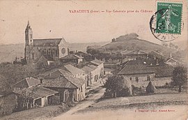 Varacieux at the start of the 20th century | |
show Location of Varacieux | |
 Varacieux | |
| Coordinates: 45°13′58″N 5°20′18″E / 45.2328°N 5.3383°ECoordinates: 45°13′58″N 5°20′18″E / 45.2328°N 5.3383°E | |
| Country | France |
| Region | Auvergne-Rhône-Alpes |
| Department | Isère |
| Arrondissement | Grenoble |
| Canton | Le Sud Grésivaudan |
| Government | |
| • Mayor (2020–2026) | Denis Chevallier |
| Area 1 | 18.48 km2 (7.14 sq mi) |
| Population (Jan. 2018)[1] | 842 |
| • Density | 46/km2 (120/sq mi) |
| Time zone | UTC+01:00 (CET) |
| • Summer (DST) | UTC+02:00 (CEST) |
| INSEE/Postal code | 38523 /38470 |
| Elevation | 326–704 m (1,070–2,310 ft) (avg. 418 m or 1,371 ft) |
| 1 French Land Register data, which excludes lakes, ponds, glaciers > 1 km2 (0.386 sq mi or 247 acres) and river estuaries. | |


show This article may be expanded with text translated from the corresponding article in French. (December 2009) Click [show] for important translation instructions. |
Varacieux (French pronunciation: [vaʁasjø]) is a commune in the Isère department in southeastern France.
Population[]
| Year | Pop. | ±% |
|---|---|---|
| 1793 | 981 | — |
| 1806 | 1,122 | +14.4% |
| 1821 | 1,181 | +5.3% |
| 1831 | 1,216 | +3.0% |
| 1841 | 1,147 | −5.7% |
| 1851 | 1,181 | +3.0% |
| 1861 | 1,199 | +1.5% |
| 1872 | 1,140 | −4.9% |
| 1881 | 1,098 | −3.7% |
| 1891 | 1,111 | +1.2% |
| 1901 | 1,043 | −6.1% |
| 1911 | 923 | −11.5% |
| 1921 | 818 | −11.4% |
| 1931 | 813 | −0.6% |
| 1946 | 832 | +2.3% |
| 1954 | 736 | −11.5% |
| 1962 | 728 | −1.1% |
| 1968 | 691 | −5.1% |
| 1975 | 661 | −4.3% |
| 1982 | 716 | +8.3% |
| 1990 | 643 | −10.2% |
| 1999 | 749 | +16.5% |
| 2006 | 749 | +0.0% |
| 2012 | 854 | +14.0% |
See also[]
References[]
- ^ "Populations légales 2018". INSEE. 28 December 2020.
| Wikimedia Commons has media related to Varacieux. |
This Isère geographical article is a stub. You can help Wikipedia by . |
Categories:
- Communes of Isère
- Isère geography stubs