Lalley
Lalley | |
|---|---|
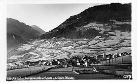 Lalley in the early 20th century | |
show Location of Lalley | |
 Lalley | |
| Coordinates: 44°45′31″N 5°40′37″E / 44.7586°N 5.6769°ECoordinates: 44°45′31″N 5°40′37″E / 44.7586°N 5.6769°E | |
| Country | France |
| Region | Auvergne-Rhône-Alpes |
| Department | Isère |
| Arrondissement | Grenoble |
| Canton | Matheysine-Trièves |
| Intercommunality | Trièves |
| Government | |
| • Mayor (2020–2026) | Christian Fierry-Fraillon |
| Area 1 | 24 km2 (9 sq mi) |
| Population (Jan. 2018)[1] | 193 |
| • Density | 8.0/km2 (21/sq mi) |
| Time zone | UTC+01:00 (CET) |
| • Summer (DST) | UTC+02:00 (CEST) |
| INSEE/Postal code | 38204 /38930 |
| Elevation | 673–2,045 m (2,208–6,709 ft) |
| 1 French Land Register data, which excludes lakes, ponds, glaciers > 1 km2 (0.386 sq mi or 247 acres) and river estuaries. | |


show This article may be expanded with text translated from the corresponding article in French. (December 2009) Click [show] for important translation instructions. |
Lalley (French pronunciation: [lalɛ]) is a commune in the Isère department in southeastern France.
Population[]
|
|
See also[]
References[]
- ^ "Populations légales 2018". INSEE. 28 December 2020.
| Wikimedia Commons has media related to Lalley. |
This Isère geographical article is a stub. You can help Wikipedia by . |
Categories:
- Communes of Isère
- Isère geography stubs