Porcieu-Amblagnieu
Porcieu-Amblagnieu | |
|---|---|
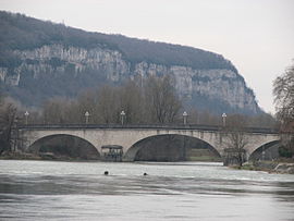 The bridge of Sault-Brénaz | |
show Location of Porcieu-Amblagnieu | |
 Porcieu-Amblagnieu | |
| Coordinates: 45°50′06″N 5°24′06″E / 45.835°N 5.4017°ECoordinates: 45°50′06″N 5°24′06″E / 45.835°N 5.4017°E | |
| Country | France |
| Region | Auvergne-Rhône-Alpes |
| Department | Isère |
| Arrondissement | La Tour-du-Pin |
| Canton | Morestel |
| Government | |
| • Mayor (2020–2026) | Nathalie Peju |
| Area 1 | 15.8 km2 (6.1 sq mi) |
| Population (Jan. 2018)[1] | 1,776 |
| • Density | 110/km2 (290/sq mi) |
| Time zone | UTC+01:00 (CET) |
| • Summer (DST) | UTC+02:00 (CEST) |
| INSEE/Postal code | 38320 /38390 |
| Elevation | 191–395 m (627–1,296 ft) |
| 1 French Land Register data, which excludes lakes, ponds, glaciers > 1 km2 (0.386 sq mi or 247 acres) and river estuaries. | |


show This article may be expanded with text translated from the corresponding article in French. (December 2009) Click [show] for important translation instructions. |
Porcieu-Amblagnieu (French pronunciation: [pɔʁsjø ɑ̃blaɲø]) is a commune in the Isère department in southeastern France.
Population[]
| Year | Pop. | ±% |
|---|---|---|
| 1793 | 459 | — |
| 1806 | 562 | +22.4% |
| 1821 | 647 | +15.1% |
| 1831 | 752 | +16.2% |
| 1841 | 960 | +27.7% |
| 1851 | 1,652 | +72.1% |
| 1861 | 1,217 | −26.3% |
| 1872 | 1,182 | −2.9% |
| 1881 | 1,289 | +9.1% |
| 1891 | 1,311 | +1.7% |
| 1901 | 1,523 | +16.2% |
| 1911 | 1,420 | −6.8% |
| 1921 | 1,104 | −22.3% |
| 1931 | 1,122 | +1.6% |
| 1946 | 855 | −23.8% |
| 1954 | 813 | −4.9% |
| 1962 | 1,003 | +23.4% |
| 1968 | 1,105 | +10.2% |
| 1975 | 1,096 | −0.8% |
| 1982 | 1,099 | +0.3% |
| 1990 | 1,086 | −1.2% |
| 2006 | 1,445 | +33.1% |
| 2011 | 1,631 | +12.9% |
See also[]
References[]
- ^ "Populations légales 2018". INSEE. 28 December 2020.
External links[]
| Wikimedia Commons has media related to Porcieu-Amblagnieu. |
This Isère geographical article is a stub. You can help Wikipedia by . |
Categories:
- Communes of Isère
- Ambarri
- Isère geography stubs