Marcilloles
Marcilloles | |
|---|---|
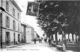 Marcilolles in 1911 | |
show Location of Marcilloles | |
 Marcilloles | |
| Coordinates: 45°20′28″N 5°11′04″E / 45.3411°N 5.1844°ECoordinates: 45°20′28″N 5°11′04″E / 45.3411°N 5.1844°E | |
| Country | France |
| Region | Auvergne-Rhône-Alpes |
| Department | Isère |
| Arrondissement | Vienne |
| Canton | Bièvre |
| Intercommunality | Bièvre Isère |
| Government | |
| • Mayor (2020–2026) | Dominique Primat |
| Area 1 | 9.5 km2 (3.7 sq mi) |
| Population (Jan. 2018)[1] | 1,140 |
| • Density | 120/km2 (310/sq mi) |
| Time zone | UTC+01:00 (CET) |
| • Summer (DST) | UTC+02:00 (CEST) |
| INSEE/Postal code | 38218 /38260 |
| Elevation | 288–351 m (945–1,152 ft) (avg. 311 m or 1,020 ft) |
| 1 French Land Register data, which excludes lakes, ponds, glaciers > 1 km2 (0.386 sq mi or 247 acres) and river estuaries. | |


show This article may be expanded with text translated from the corresponding article in French. (December 2009) Click [show] for important translation instructions. |
Marcilloles (French pronunciation: [maʁsijɔl]) is a commune in the Isère department in southeastern France.
Population[]
|
|
See also[]
References[]
- ^ "Populations légales 2018". INSEE. 28 December 2020.
| Wikimedia Commons has media related to Marcilloles. |
This Isère geographical article is a stub. You can help Wikipedia by . |
Categories:
- Communes of Isère
- Isère geography stubs