Four, Isère
Four | |
|---|---|
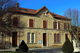 The town hall of Four | |
show Location of Four | |
 Four | |
| Coordinates: 45°35′17″N 5°11′47″E / 45.5881°N 5.1964°ECoordinates: 45°35′17″N 5°11′47″E / 45.5881°N 5.1964°E | |
| Country | France |
| Region | Auvergne-Rhône-Alpes |
| Department | Isère |
| Arrondissement | La Tour-du-Pin |
| Canton | L'Isle-d'Abeau |
| Intercommunality | CA Porte de l'Isère |
| Government | |
| • Mayor (2020–2026) | Jean Papadopulo[1] |
| Area 1 | 11.82 km2 (4.56 sq mi) |
| Population (Jan. 2018)[2] | 1,582 |
| • Density | 130/km2 (350/sq mi) |
| Time zone | UTC+01:00 (CET) |
| • Summer (DST) | UTC+02:00 (CEST) |
| INSEE/Postal code | 38172 /38080 |
| Elevation | 270–529 m (886–1,736 ft) (avg. 330 m or 1,080 ft) |
| 1 French Land Register data, which excludes lakes, ponds, glaciers > 1 km2 (0.386 sq mi or 247 acres) and river estuaries. | |


show This article may be expanded with text translated from the corresponding article in French. (December 2009) Click [show] for important translation instructions. |
Four is a commune in the Isère department in southeastern France.
Population[]
|
|
Twin towns[]
Four is twinned with:
 Pusiano, Italy, since 2013
See also[]
References[]
- ^ "Répertoire national des élus: les maires". data.gouv.fr, Plateforme ouverte des données publiques françaises (in French). 2 December 2020.
- ^ "Populations légales 2018". INSEE. 28 December 2020.
| Wikimedia Commons has media related to Four (Isère). |
| show Authority control |
|---|
This Isère geographical article is a stub. You can help Wikipedia by . |
Categories:
- Communes of Isère
- Isère geography stubs