Montchaboud
Montchaboud | |
|---|---|
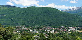 A general view of Montchaboud | |
show Location of Montchaboud | |
 Montchaboud | |
| Coordinates: 45°05′43″N 5°45′46″E / 45.0953°N 5.7629°ECoordinates: 45°05′43″N 5°45′46″E / 45.0953°N 5.7629°E | |
| Country | France |
| Region | Auvergne-Rhône-Alpes |
| Department | Isère |
| Arrondissement | Grenoble |
| Canton | Oisans-Romanche |
| Intercommunality | Grenoble-Alpes Métropole |
| Government | |
| • Mayor (2020–2026) | Guy Soto |
| Area 1 | 1.96 km2 (0.76 sq mi) |
| Population (Jan. 2018)[1] | 337 |
| • Density | 170/km2 (450/sq mi) |
| Time zone | UTC+01:00 (CET) |
| • Summer (DST) | UTC+02:00 (CEST) |
| INSEE/Postal code | 38252 /38220 |
| Elevation | 261–733 m (856–2,405 ft) (avg. 522 m or 1,713 ft) |
| 1 French Land Register data, which excludes lakes, ponds, glaciers > 1 km2 (0.386 sq mi or 247 acres) and river estuaries. | |


show This article may be expanded with text translated from the corresponding article in French. (December 2009) Click [show] for important translation instructions. |
Montchaboud (French pronunciation: [mɔ̃ʃabu]) is a commune in the Isère department in southeastern France.
Population[]
| Year | Pop. | ±% |
|---|---|---|
| 1800 | 107 | — |
| 1806 | 77 | −28.0% |
| 1821 | 77 | +0.0% |
| 1831 | 76 | −1.3% |
| 1841 | 66 | −13.2% |
| 1851 | 77 | +16.7% |
| 8161 | 74 | −3.9% |
| 1872 | 72 | −2.7% |
| 1881 | 72 | +0.0% |
| 1891 | 62 | −13.9% |
| 1901 | 60 | −3.2% |
| 1911 | 47 | −21.7% |
| 1921 | 39 | −17.0% |
| 1931 | 37 | −5.1% |
| 1946 | 35 | −5.4% |
| 1954 | 40 | +14.3% |
| 1962 | 38 | −5.0% |
| 1968 | 52 | +36.8% |
| 1975 | 228 | +338.5% |
| 1982 | 310 | +36.0% |
| 1990 | 305 | −1.6% |
| 1999 | 335 | +9.8% |
| 2006 | 352 | +5.1% |
| 2011 | 368 | +4.5% |
See also[]
References[]
- ^ "Populations légales 2018". INSEE. 28 December 2020.
| Wikimedia Commons has media related to Montchaboud. |
This Isère geographical article is a stub. You can help Wikipedia by . |
Categories:
- Communes of Isère
- Isère geography stubs