Plan, Isère
Plan | |
|---|---|
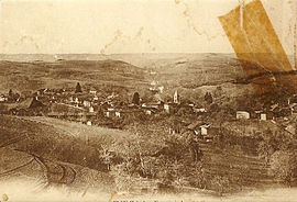 Plan at the start of the 20th century | |
show Location of Plan | |
 Plan | |
| Coordinates: 45°18′49″N 5°23′36″E / 45.3136°N 5.3933°ECoordinates: 45°18′49″N 5°23′36″E / 45.3136°N 5.3933°E | |
| Country | France |
| Region | Auvergne-Rhône-Alpes |
| Department | Isère |
| Arrondissement | Vienne |
| Canton | Bièvre |
| Government | |
| • Mayor (2014–2020) | Jean-Paul Bernard |
| Area 1 | 6.1 km2 (2.4 sq mi) |
| Population (Jan. 2018)[1] | 263 |
| • Density | 43/km2 (110/sq mi) |
| Time zone | UTC+01:00 (CET) |
| • Summer (DST) | UTC+02:00 (CEST) |
| INSEE/Postal code | 38308 /38590 |
| Elevation | 452–785 m (1,483–2,575 ft) (avg. 600 m or 2,000 ft) |
| 1 French Land Register data, which excludes lakes, ponds, glaciers > 1 km2 (0.386 sq mi or 247 acres) and river estuaries. | |


show This article may be expanded with text translated from the corresponding article in French. (December 2009) Click [show] for important translation instructions. |
Plan is a commune in the Isère department in southeastern France.
Population[]
| Year | Pop. | ±% |
|---|---|---|
| 1793 | 253 | — |
| 1806 | 270 | +6.7% |
| 1821 | 311 | +15.2% |
| 1841 | 343 | +10.3% |
| 1851 | 315 | −8.2% |
| 1861 | 304 | −3.5% |
| 1872 | 286 | −5.9% |
| 1881 | 264 | −7.7% |
| 1891 | 256 | −3.0% |
| 1901 | 263 | +2.7% |
| 1911 | 228 | −13.3% |
| 1921 | 197 | −13.6% |
| 1931 | 171 | −13.2% |
| 1946 | 162 | −5.3% |
| 1954 | 162 | +0.0% |
| 1962 | 143 | −11.7% |
| 1968 | 125 | −12.6% |
| 1975 | 113 | −9.6% |
| 1982 | 147 | +30.1% |
| 1990 | 184 | +25.2% |
| 1999 | 182 | −1.1% |
| 2006 | 221 | +21.4% |
| 2011 | 250 | +13.1% |
See also[]
References[]
| Wikimedia Commons has media related to Plan (Isère). |
- ^ "Populations légales 2018". INSEE. 28 December 2020.
| show Authority control |
|---|
This Isère geographical article is a stub. You can help Wikipedia by . |
Categories:
- Communes of Isère
- Isère geography stubs