Chèzeneuve
Chèzeneuve | |
|---|---|
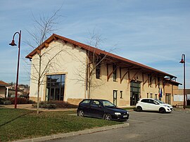 The town hall of Chèzeneuve | |
show Location of Chèzeneuve | |
 Chèzeneuve | |
| Coordinates: 45°33′47″N 5°13′27″E / 45.5631°N 5.2242°ECoordinates: 45°33′47″N 5°13′27″E / 45.5631°N 5.2242°E | |
| Country | France |
| Region | Auvergne-Rhône-Alpes |
| Department | Isère |
| Arrondissement | La Tour-du-Pin |
| Canton | L'Isle-d'Abeau |
| Intercommunality | CA Porte de l'Isère |
| Government | |
| • Mayor (2020–2026) | Emmanuelle Bouin |
| Area 1 | 6.79 km2 (2.62 sq mi) |
| Population (Jan. 2018)[1] | 611 |
| • Density | 90/km2 (230/sq mi) |
| Time zone | UTC+01:00 (CET) |
| • Summer (DST) | UTC+02:00 (CEST) |
| INSEE/Postal code | 38102 /38300 |
| Elevation | 400–529 m (1,312–1,736 ft) (avg. 480 m or 1,570 ft) |
| 1 French Land Register data, which excludes lakes, ponds, glaciers > 1 km2 (0.386 sq mi or 247 acres) and river estuaries. | |


Chèzeneuve (French pronunciation: [ʃɛznœv]) is a commune in the Isère department in southeastern France.
Population[]
| Year | Pop. | ±% |
|---|---|---|
| 1800 | 356 | — |
| 1821 | 350 | −1.7% |
| 1831 | 429 | +22.6% |
| 1841 | 403 | −6.1% |
| 1851 | 438 | +8.7% |
| 1861 | 407 | −7.1% |
| 1872 | 337 | −17.2% |
| 1881 | 313 | −7.1% |
| 1891 | 273 | −12.8% |
| 1901 | 269 | −1.5% |
| 1911 | 265 | −1.5% |
| 1921 | 246 | −7.2% |
| 1931 | 280 | +13.8% |
| 1946 | 221 | −21.1% |
| 1954 | 255 | +15.4% |
| 1962 | 257 | +0.8% |
| 1968 | 247 | −3.9% |
| 1975 | 234 | −5.3% |
| 1982 | 306 | +30.8% |
| 1990 | 339 | +10.8% |
| 1999 | 373 | +10.0% |
| 2011 | 504 | +35.1% |
See also[]
References[]
- ^ "Populations légales 2018". INSEE. 28 December 2020.
| Wikimedia Commons has media related to Chèzeneuve. |
This Isère geographical article is a stub. You can help Wikipedia by . |
Categories:
- Communes of Isère
- Isère geography stubs