Chaveyriat
Chaveyriat | |
|---|---|
Commune | |
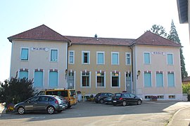 Town hall and school | |
Location of Chaveyriat  | |
 Chaveyriat | |
| Coordinates: 46°11′00″N 5°04′00″E / 46.1833°N 5.0667°ECoordinates: 46°11′00″N 5°04′00″E / 46.1833°N 5.0667°E | |
| Country | France |
| Region | Auvergne-Rhône-Alpes |
| Department | Ain |
| Arrondissement | Bourg-en-Bresse |
| Canton | Vonnas |
| Intercommunality | |
| Government | |
| • Mayor (2020–2026) | Claude Jacquet |
| Area 1 | 16.87 km2 (6.51 sq mi) |
| Population (Jan. 2018)[1] | 1,011 |
| • Density | 60/km2 (160/sq mi) |
| Time zone | UTC+01:00 (CET) |
| • Summer (DST) | UTC+02:00 (CEST) |
| INSEE/Postal code | 01096 /01660 |
| Elevation | 188–260 m (617–853 ft) (avg. 245 m or 804 ft) |
| 1 French Land Register data, which excludes lakes, ponds, glaciers > 1 km2 (0.386 sq mi or 247 acres) and river estuaries. | |


Chaveyriat (French pronunciation: [ʃaveʁja]) is a commune in the Ain department in eastern France. It sits north of the D396 road, and is located 7 km north east of Neuville-les-Dames and 13 km west of Bourg-en-Bresse.
The romanesque parish church is dedicated to St John the Baptist.
History[]
The first mention of the town dates from 933 under the name of Cavariaco in the collection of Charters of Cluny.
The castle of Chaveyriat was destroyed in 1376 by the troops of the Sire de Beaujeu, it had been the home of Hugues de Marchant, then, successively, was held by the families of Columbus, Cheminant, Varax, de la Cley.
In 1601, after the Treaty of Lyons, Chaveyriat became part of the Burgundy province of France.
Between 1790 and 1795, it became a municipality in the canton of Châtillon-les-Dombes.
Population[]
| Year | Pop. | ±% |
|---|---|---|
| 2006 | 885 | — |
| 2007 | 896 | +1.2% |
| 2008 | 907 | +1.2% |
| 2009 | 922 | +1.7% |
| 2010 | 927 | +0.5% |
| 2011 | 943 | +1.7% |
| 2012 | 959 | +1.7% |
| 2013 | 975 | +1.7% |
| 2014 | 993 | +1.8% |
| 2015 | 1,003 | +1.0% |
| 2016 | 1,006 | +0.3% |
See also[]
References[]
- ^ "Populations légales 2018". The National Institute of Statistics and Economic Studies. 28 December 2020.
External links[]
| Wikimedia Commons has media related to Chaveyriat. |
This Ain geographical article is a stub. You can help Wikipedia by . |
- Communes of Ain
- Ain geography stubs