Ségny
show This article may be expanded with text translated from the corresponding article in French. (December 2008) Click [show] for important translation instructions. |
Ségny | |
|---|---|
Commune | |
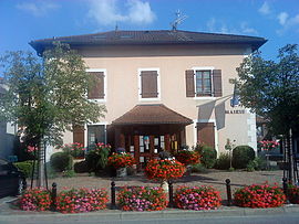 Town hall | |
 Coat of arms | |
show Location of Ségny | |
 Ségny | |
| Coordinates: 46°17′49″N 6°04′25″E / 46.2969°N 6.0736°ECoordinates: 46°17′49″N 6°04′25″E / 46.2969°N 6.0736°E | |
| Country | France |
| Region | Auvergne-Rhône-Alpes |
| Department | Ain |
| Arrondissement | Gex |
| Canton | Thoiry |
| Intercommunality | Pays de Gex |
| Government | |
| • Mayor (2020–2026) | Jean-Pierre Fouilloux[1] |
| Area 1 | 3.24 km2 (1.25 sq mi) |
| Population (Jan. 2018)[2] | 2,089 |
| • Density | 640/km2 (1,700/sq mi) |
| Time zone | UTC+01:00 (CET) |
| • Summer (DST) | UTC+02:00 (CEST) |
| INSEE/Postal code | 01399 /01170 |
| Elevation | 467–519 m (1,532–1,703 ft) (avg. 479 m or 1,572 ft) |
| 1 French Land Register data, which excludes lakes, ponds, glaciers > 1 km2 (0.386 sq mi or 247 acres) and river estuaries. | |


Ségny, also written Segny, is a commune in the Ain department in eastern France.
Ségny is situated in the east of the department, in a district of the Lake Geneva / River Rhône basin known as the Pays de Gex. It lies on the important RN 5 trunk road from Paris to Geneva and is just five minutes by road from Geneva Cointrin International Airport. A local bus service connects Ségny to Geneva city centre, which is some 13 km (8.1 mi) away.
Ségny became a member of the Pays de Gex Community of Communes on 1 January 1996. The commune is bordered by Cessy to the north, Versonnex to the east, Prévessin-Moëns and Ornex to the south, and Échenevex and Chevry to the west.
Population[]
|
|
See also[]
References[]
- ^ "Répertoire national des élus: les maires". data.gouv.fr, Plateforme ouverte des données publiques françaises (in French). 2 December 2020.
- ^ "Populations légales 2018". INSEE. 28 December 2020.
| Wikimedia Commons has media related to Ségny. |
This Ain geographical article is a stub. You can help Wikipedia by . |
Categories:
- Communes of Ain
- Ain geography stubs