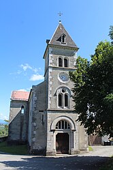
Surjoux-Lhopital
Surjoux-Lhopital | |
|---|---|
Commune | |
 | |
Location of Surjoux-Lhopital  | |
 Surjoux-Lhopital | |
| Coordinates: 46°01′19″N 5°46′45″E / 46.0219°N 5.7792°ECoordinates: 46°01′19″N 5°46′45″E / 46.0219°N 5.7792��E | |
| Country | France |
| Region | Auvergne-Rhône-Alpes |
| Department | Ain |
| Arrondissement | Nantua |
| Canton | Valserhône |
| Intercommunality | Pays Bellegardien |
| Area 1 | 7.99 km2 (3.08 sq mi) |
| Population (Jan. 2018)[1] | 137 |
| • Density | 17/km2 (44/sq mi) |
| Time zone | UTC+01:00 (CET) |
| • Summer (DST) | UTC+02:00 (CEST) |
| INSEE/Postal code | 01215 /01420 |
| Elevation | 300–1,160 m (980–3,810 ft) (avg. 490 m or 1,610 ft) |
| 1 French Land Register data, which excludes lakes, ponds, glaciers > 1 km2 (0.386 sq mi or 247 acres) and river estuaries. | |


Surjoux-Lhôpital is a commune in the Ain department in eastern France. It is the result of the merger, on 1 January 2019, of the communes of Surjoux and Lhôpital.[2]
See also[]
References[]
- ^ "Populations légales 2018". The National Institute of Statistics and Economic Studies. 28 December 2020.
- ^ Arrêté préfectoral, 3 December 2018 (in French)
| Wikimedia Commons has media related to Surjoux-Lhopital. |
This Ain geographical article is a stub. You can help Wikipedia by . |
Categories:
- Communes of Ain
- Populated places established in 2019
- 2019 establishments in France
- Ain geography stubs