Francheleins
This article may be expanded with text translated from the corresponding article in French. (December 2008) Click [show] for important translation instructions.
|
Francheleins | |
|---|---|
Commune | |
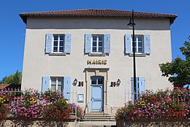 Town hall | |
Location of Francheleins  | |
 Francheleins | |
| Coordinates: 46°04′28″N 4°48′33″E / 46.0744°N 4.8092°ECoordinates: 46°04′28″N 4°48′33″E / 46.0744°N 4.8092°E | |
| Country | France |
| Region | Auvergne-Rhône-Alpes |
| Department | Ain |
| Arrondissement | Bourg-en-Bresse |
| Canton | Villars-les-Dombes |
| Intercommunality | |
| Government | |
| • Mayor (2020–2026) | Jean-Michel Lux |
| Area 1 | 13.56 km2 (5.24 sq mi) |
| Population (Jan. 2018)[1] | 1,603 |
| • Density | 120/km2 (310/sq mi) |
| Time zone | UTC+01:00 (CET) |
| • Summer (DST) | UTC+02:00 (CEST) |
| INSEE/Postal code | 01165 /01090 |
| Elevation | 209–269 m (686–883 ft) (avg. 213 m or 699 ft) |
| 1 French Land Register data, which excludes lakes, ponds, glaciers > 1 km2 (0.386 sq mi or 247 acres) and river estuaries. | |


Francheleins is a commune in the Ain department in eastern France.
Population[]
| Year | Pop. | ±% |
|---|---|---|
| 2005 | 1,098 | — |
| 2006 | 1,125 | +2.5% |
| 2007 | 1,165 | +3.6% |
| 2008 | 1,218 | +4.5% |
| 2009 | 1,270 | +4.3% |
| 2010 | 1,323 | +4.2% |
| 2011 | 1,370 | +3.6% |
| 2012 | 1,450 | +5.8% |
| 2013 | 1,482 | +2.2% |
| 2014 | 1,515 | +2.2% |
| 2015 | 1,548 | +2.2% |
| 2016 | 1,574 | +1.7% |
See also[]
References[]
- ^ "Populations légales 2018". The National Institute of Statistics and Economic Studies. 28 December 2020.
| Wikimedia Commons has media related to Francheleins. |
This Ain geographical article is a stub. You can help Wikipedia by . |
Categories:
- Communes of Ain
- Ain geography stubs