Montréal-la-Cluse
show This article may be expanded with text translated from the corresponding article in French. (December 2008) Click [show] for important translation instructions. |
Montréal-la-Cluse | |
|---|---|
Commune | |
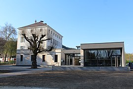 The town hall in Montréal-la-Cluse | |
 Coat of arms | |
show Location of Montréal-la-Cluse | |
 Montréal-la-Cluse | |
| Coordinates: 46°11′00″N 5°34′00″E / 46.1833°N 5.5667°ECoordinates: 46°11′00″N 5°34′00″E / 46.1833°N 5.5667°E | |
| Country | France |
| Region | Auvergne-Rhône-Alpes |
| Department | Ain |
| Arrondissement | Nantua |
| Canton | Nantua |
| Intercommunality | Haut-Bugey Agglomération |
| Government | |
| • Mayor (2020–2026) | Patrick Dufour |
| Area 1 | 12.83 km2 (4.95 sq mi) |
| Population (Jan. 2018)[1] | 3,419 |
| • Density | 270/km2 (690/sq mi) |
| Time zone | UTC+01:00 (CET) |
| • Summer (DST) | UTC+02:00 (CEST) |
| INSEE/Postal code | 01265 /01460 |
| 1 French Land Register data, which excludes lakes, ponds, glaciers > 1 km2 (0.386 sq mi or 247 acres) and river estuaries. | |


Montréal-la-Cluse (French pronunciation: [mɔ̃ʁe.al la klyz] (![]() listen)) is a commune in the Ain department in eastern France. It is located in the historical region of Bugey and its inhabitants are known as the Montréalais.
listen)) is a commune in the Ain department in eastern France. It is located in the historical region of Bugey and its inhabitants are known as the Montréalais.
Transport[]
The town is served by the Haut Bougey railway line and by a branch line to Oyonnax.
Population[]
|
|
See also[]
References[]
- ^ "Populations légales 2018". INSEE. 28 December 2020.
External links[]
| Wikimedia Commons has media related to Montréal-la-Cluse. |
| show Authority control |
|---|
This Ain geographical article is a stub. You can help Wikipedia by . |
Categories:
- Communes of Ain
- Ain geography stubs