Neyron
This article may be expanded with text translated from the corresponding article in French. (December 2008) Click [show] for important translation instructions.
|
Neyron | |
|---|---|
Commune | |
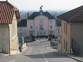 Town hall | |
Location of Neyron  | |
 Neyron | |
| Coordinates: 45°48′49″N 4°55′50″E / 45.8136°N 4.9306°ECoordinates: 45°48′49″N 4°55′50″E / 45.8136°N 4.9306°E | |
| Country | France |
| Region | Auvergne-Rhône-Alpes |
| Department | Ain |
| Arrondissement | Bourg-en-Bresse |
| Canton | Miribel |
| Intercommunality | CC Miribel et Plateau |
| Government | |
| • Mayor (2020–2026) | Jean-Yves Girard |
| Area 1 | 5.4 km2 (2.1 sq mi) |
| Population (Jan. 2018)[1] | 2,549 |
| • Density | 470/km2 (1,200/sq mi) |
| Time zone | UTC+01:00 (CET) |
| • Summer (DST) | UTC+02:00 (CEST) |
| INSEE/Postal code | 01275 /01700 |
| Elevation | 165–312 m (541–1,024 ft) (avg. 190 m or 620 ft) |
| 1 French Land Register data, which excludes lakes, ponds, glaciers > 1 km2 (0.386 sq mi or 247 acres) and river estuaries. | |


Neyron (French pronunciation: [neʁɔ̃] (![]() listen)) is a commune in the Ain department in eastern France.
listen)) is a commune in the Ain department in eastern France.
Population[]
|
|
See also[]
References[]
- ^ "Populations légales 2018". The National Institute of Statistics and Economic Studies. 28 December 2020.
| Wikimedia Commons has media related to Neyron. |
This Ain geographical article is a stub. You can help Wikipedia by . |
Categories:
- Communes of Ain
- Ain geography stubs