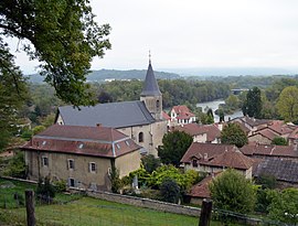
Varambon
This article may be expanded with text translated from the corresponding article in French. (December 2008) Click [show] for important translation instructions.
|
Varambon | |
|---|---|
Commune | |
 | |
 Coat of arms | |
Location of Varambon  | |
 Varambon | |
| Coordinates: 46°02′00″N 5°19′00″E / 46.0333°N 5.3167°ECoordinates: 46°02′00″N 5°19′00″E / 46.0333°N 5.3167°E | |
| Country | France |
| Region | Auvergne-Rhône-Alpes |
| Department | Ain |
| Arrondissement | Nantua |
| Canton | Pont-d'Ain |
| Intercommunality | Rives de l'Ain - Pays du Cerdon |
| Government | |
| • Mayor (2020–2026) | Dominique Gabasio |
| Area 1 | 7.99 km2 (3.08 sq mi) |
| Population (Jan. 2018)[1] | 601 |
| • Density | 75/km2 (190/sq mi) |
| Time zone | UTC+01:00 (CET) |
| • Summer (DST) | UTC+02:00 (CEST) |
| INSEE/Postal code | 01430 /01300 |
| Elevation | 228–347 m (748–1,138 ft) |
| 1 French Land Register data, which excludes lakes, ponds, glaciers > 1 km2 (0.386 sq mi or 247 acres) and river estuaries. | |


Varambon (French pronunciation: [vaʁɑ̃bɔ̃]) is a commune in the Ain department in eastern France.
Population[]
|
|
See also[]
References[]
- ^ "Populations légales 2018". The National Institute of Statistics and Economic Studies. 28 December 2020.
| Wikimedia Commons has media related to Varambon. |
This Ain geographical article is a stub. You can help Wikipedia by . |
Categories:
- Communes of Ain
- Ain geography stubs