Ramasse
This article may be expanded with text translated from the corresponding article in French. (December 2008) Click [show] for important translation instructions.
|
Ramasse | |
|---|---|
Commune | |
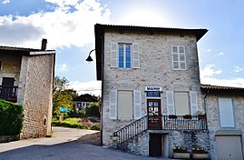 Town hall | |
Location of Ramasse  | |
 Ramasse | |
| Coordinates: 46°11′42″N 5°21′19″E / 46.195°N 5.3553°ECoordinates: 46°11′42″N 5°21′19″E / 46.195°N 5.3553°E | |
| Country | France |
| Region | Auvergne-Rhône-Alpes |
| Department | Ain |
| Arrondissement | Bourg-en-Bresse |
| Canton | Saint-Étienne-du-Bois |
| Intercommunality | Bassin de Bourg-en-Bresse |
| Government | |
| • Mayor (2020–2026) | Christian Passaquet[1] |
| Area 1 | 9.86 km2 (3.81 sq mi) |
| Population (Jan. 2018)[2] | 327 |
| • Density | 33/km2 (86/sq mi) |
| Time zone | UTC+01:00 (CET) |
| • Summer (DST) | UTC+02:00 (CEST) |
| INSEE/Postal code | 01317 /01250 |
| Elevation | 310–590 m (1,020–1,940 ft) (avg. 338 m or 1,109 ft) |
| 1 French Land Register data, which excludes lakes, ponds, glaciers > 1 km2 (0.386 sq mi or 247 acres) and river estuaries. | |


Ramasse is a commune in the Ain department in eastern France.
Population[]
| Year | Pop. | ±% |
|---|---|---|
| 2004 | 255 | — |
| 2006 | 264 | +3.5% |
| 2007 | 259 | −1.9% |
| 2008 | 255 | −1.5% |
| 2009 | 250 | −2.0% |
| 2010 | 250 | +0.0% |
| 2011 | 254 | +1.6% |
| 2012 | 271 | +6.7% |
| 2013 | 288 | +6.3% |
| 2014 | 305 | +5.9% |
| 2015 | 312 | +2.3% |
| 2016 | 321 | +2.9% |
See also[]
References[]
- ^ "Répertoire national des élus: les maires". data.gouv.fr, Plateforme ouverte des données publiques françaises (in French). 9 August 2021.
- ^ "Populations légales 2018". The National Institute of Statistics and Economic Studies. 28 December 2020.
| Wikimedia Commons has media related to Ramasse. |
This Ain geographical article is a stub. You can help Wikipedia by . |
Categories:
- Communes of Ain
- Ain geography stubs