La Burbanche
show This article may be expanded with text translated from the corresponding article in French. (December 2008) Click [show] for important translation instructions. |
La Burbanche | |
|---|---|
Commune | |
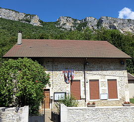 The town hall in La Burbanche | |
show Location of La Burbanche | |
 La Burbanche | |
| Coordinates: 45°51′00″N 5°34′00″E / 45.85°N 5.5667°ECoordinates: 45°51′00″N 5°34′00″E / 45.85°N 5.5667°E | |
| Country | France |
| Region | Auvergne-Rhône-Alpes |
| Department | Ain |
| Arrondissement | Belley |
| Canton | Belley |
| Intercommunality | |
| Government | |
| • Mayor (2020–2026) | Patrick Marié[1] |
| Area 1 | 10.82 km2 (4.18 sq mi) |
| Population (Jan. 2018)[2] | 83 |
| • Density | 7.7/km2 (20/sq mi) |
| Time zone | UTC+01:00 (CET) |
| • Summer (DST) | UTC+02:00 (CEST) |
| INSEE/Postal code | 01066 /01510 |
| Elevation | 334–860 m (1,096–2,822 ft) (avg. 350 m or 1,150 ft) |
| 1 French Land Register data, which excludes lakes, ponds, glaciers > 1 km2 (0.386 sq mi or 247 acres) and river estuaries. | |


La Burbanche is a commune in the Ain department in eastern France.
Population[]
| Year | Pop. | ±% |
|---|---|---|
| 2004 | 63 | — |
| 2006 | 63 | +0.0% |
| 2007 | 65 | +3.2% |
| 2008 | 68 | +4.6% |
| 2009 | 70 | +2.9% |
| 2010 | 72 | +2.9% |
| 2011 | 74 | +2.8% |
| 2012 | 73 | −1.4% |
| 2013 | 72 | −1.4% |
| 2014 | 71 | −1.4% |
| 2015 | 71 | +0.0% |
| 2016 | 71 | +0.0% |
See also[]
References[]
- ^ "Répertoire national des élus: les maires". data.gouv.fr, Plateforme ouverte des données publiques françaises (in French). 2 December 2020.
- ^ "Populations légales 2018". INSEE. 28 December 2020.
| Wikimedia Commons has media related to La Burbanche. |
This Ain geographical article is a stub. You can help Wikipedia by . |
Categories:
- Communes of Ain
- Ain geography stubs