Cormoz
This article may be expanded with text translated from the corresponding article in French. (December 2008) Click [show] for important translation instructions.
|
Cormoz | |
|---|---|
Commune | |
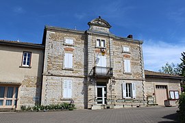 Town hall | |
Location of Cormoz  | |
 Cormoz | |
| Coordinates: 46°27′00″N 5°14′00″E / 46.45°N 5.2333°ECoordinates: 46°27′00″N 5°14′00″E / 46.45°N 5.2333°E | |
| Country | France |
| Region | Auvergne-Rhône-Alpes |
| Department | Ain |
| Arrondissement | Bourg-en-Bresse |
| Canton | Saint-Étienne-du-Bois |
| Intercommunality | CA Bassin de Bourg-en-Bresse |
| Government | |
| • Mayor (2020–2026) | Nicolas Schweitzer |
| Area 1 | 19.56 km2 (7.55 sq mi) |
| Population (Jan. 2018)[1] | 677 |
| • Density | 35/km2 (90/sq mi) |
| Time zone | UTC+01:00 (CET) |
| • Summer (DST) | UTC+02:00 (CEST) |
| INSEE/Postal code | 01124 /01560 |
| Elevation | 187–223 m (614–732 ft) (avg. 210 m or 690 ft) |
| 1 French Land Register data, which excludes lakes, ponds, glaciers > 1 km2 (0.386 sq mi or 247 acres) and river estuaries. | |


Cormoz (French pronunciation: [kɔʁmo]) is a commune in the Ain department in eastern France.
Geography[]
The Sâne Morte forms the commune's western border. The Sevron forms the commune's eastern border.
Population[]
| Year | Pop. | ±% |
|---|---|---|
| 1793 | 1,035 | — |
| 1800 | 1,083 | +4.6% |
| 1806 | 1,074 | −0.8% |
| 1821 | 1,043 | −2.9% |
| 1831 | 1,061 | +1.7% |
| 1836 | 1,136 | +7.1% |
| 1841 | 1,080 | −4.9% |
| 1846 | 1,080 | +0.0% |
| 1851 | 1,157 | +7.1% |
| 1856 | 1,091 | −5.7% |
| 1861 | 1,089 | −0.2% |
| 1866 | 1,154 | +6.0% |
| 1872 | 1,167 | +1.1% |
| 1876 | 1,185 | +1.5% |
| 1881 | 1,174 | −0.9% |
| 1886 | 1,175 | +0.1% |
| 1891 | 1,120 | −4.7% |
| 1896 | 1,104 | −1.4% |
| 1901 | 1,077 | −2.4% |
| 1906 | 1,055 | −2.0% |
| 1911 | 1,075 | +1.9% |
| 1921 | 924 | −14.0% |
| 1926 | 996 | +7.8% |
| 1931 | 944 | −5.2% |
| 1936 | 909 | −3.7% |
| 1946 | 867 | −4.6% |
| 1954 | 767 | −11.5% |
| 1962 | 708 | −7.7% |
| 1968 | 640 | −9.6% |
| 1975 | 572 | −10.6% |
| 1982 | 550 | −3.8% |
| 1990 | 502 | −8.7% |
| 1999 | 512 | +2.0% |
| 2008 | 547 | +6.8% |
See also[]
References[]
- ^ "Populations légales 2018". The National Institute of Statistics and Economic Studies. 28 December 2020.
| Wikimedia Commons has media related to Cormoz. |
This Ain geographical article is a stub. You can help Wikipedia by . |
Categories:
- Communes of Ain
- Ain geography stubs