Fleury-sur-Andelle
Fleury-sur-Andelle | |
|---|---|
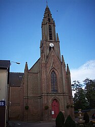 The church in Fleury-sur-Andelle | |
 Coat of arms | |
show Location of Fleury-sur-Andelle | |
 Fleury-sur-Andelle | |
| Coordinates: 49°21′46″N 1°21′22″E / 49.3628°N 1.3561°ECoordinates: 49°21′46″N 1°21′22″E / 49.3628°N 1.3561°E | |
| Country | France |
| Region | Normandy |
| Department | Eure |
| Arrondissement | Les Andelys |
| Canton | Romilly-sur-Andelle |
| Government | |
| • Mayor (2020–2026) | Rémi Vieillard |
| Area 1 | 3.79 km2 (1.46 sq mi) |
| Population (Jan. 2018)[1] | 1,838 |
| • Density | 480/km2 (1,300/sq mi) |
| Time zone | UTC+01:00 (CET) |
| • Summer (DST) | UTC+02:00 (CEST) |
| INSEE/Postal code | 27246 /27380 |
| Elevation | 25–125 m (82–410 ft) (avg. 30 m or 98 ft) |
| 1 French Land Register data, which excludes lakes, ponds, glaciers > 1 km2 (0.386 sq mi or 247 acres) and river estuaries. | |


Fleury-sur-Andelle (French pronunciation: [flœʁi syʁ ɑ̃dɛl], literally Fleury on Andelle) is a commune in the Eure department in the Normandy region in northern France.
Population[]
| Year | Pop. | ±% |
|---|---|---|
| 1821 | 238 | — |
| 1851 | 1,587 | +566.8% |
| 1962 | 1,528 | −3.7% |
| 1968 | 1,604 | +5.0% |
| 1975 | 1,817 | +13.3% |
| 1982 | 2,039 | +12.2% |
| 1990 | 2,015 | −1.2% |
| 1999 | 1,923 | −4.6% |
| 2008 | 1,879 | −2.3% |
International relations[]
It is twinned with East Goscote, Leicestershire.
See also[]
- Communes of the Eure department
References[]
- ^ "Populations légales 2018". INSEE. 28 December 2020.
| Wikimedia Commons has media related to Fleury-sur-Andelle. |
| show Communes of the Eure department |
|---|
| show Authority control |
|---|
This Eure geographical article is a stub. You can help Wikipedia by . |
Categories:
- Communes of Eure
- Eure geography stubs