Foulbec
From Wikipedia, the free encyclopedia
Commune in Normandy, France
Foulbec | |
|---|---|
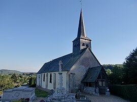 The church in Foulbec | |
 Foulbec  Foulbec | |
Coordinates:  49°24′02″N 0°25′33″E / 49.4006°N 0.4258°E / 49.4006; 0.4258Coordinates: 49°24′02″N 0°25′33″E / 49.4006°N 0.4258°E / 49.4006; 0.4258 49°24′02″N 0°25′33″E / 49.4006°N 0.4258°E / 49.4006; 0.4258Coordinates: 49°24′02″N 0°25′33″E / 49.4006°N 0.4258°E / 49.4006; 0.4258 | |
| Country | France |
| Region | Normandy |
| Department | Eure |
| Arrondissement | Bernay |
| Canton | Beuzeville |
| Government | |
| • Mayor (2020–2026) | Alain Fontaine[1] |
| Area 1 | 11.86 km2 (4.58 sq mi) |
| Population (Jan. 2018)[2] | 661 |
| • Density | 56/km2 (140/sq mi) |
| Time zone | UTC+01:00 (CET) |
| • Summer (DST) | UTC+02:00 (CEST) |
| INSEE/Postal code | 27260 /27210 |
| Elevation | 1–116 m (3.3–380.6 ft) (avg. 80 m or 260 ft) |
| 1 French Land Register data, which excludes lakes, ponds, glaciers > 1 km2 (0.386 sq mi or 247 acres) and river estuaries. | |

Foulbec is a commune in the Eure department in the Normandy region in northern France.
Population[]
| Year | Pop. | ±% |
|---|---|---|
| 1962 | 260 | — |
| 1968 | 283 | +8.8% |
| 1975 | 303 | +7.1% |
| 1982 | 353 | +16.5% |
| 1990 | 411 | +16.4% |
| 1999 | 467 | +13.6% |
| 2008 | 520 | +11.3% |
See also[]
- Communes of the Eure department
References[]
- ^ "Répertoire national des élus: les maires". data.gouv.fr, Plateforme ouverte des données publiques françaises (in French). 2 December 2020.
- ^ "Populations légales 2018". INSEE. 28 December 2020.
| Wikimedia Commons has media related to Foulbec. |
show
Communes of the Eure department | |
|---|---|
|
This Eure geographical article is a stub. You can help Wikipedia by . |
- v
- t
Retrieved from ""
Categories:
- Communes of Eure
- Eure geography stubs
Hidden categories:
- CS1 French-language sources (fr)
- Articles with short description
- Short description is different from Wikidata
- Infobox mapframe without OSM relation ID on Wikidata
- Coordinates on Wikidata
- Pages using infobox settlement with image map1 but not image map
- Commons category link from Wikidata
- Articles with BNF identifiers
- All stub articles
- Pages using the Kartographer extension