Gauciel
From Wikipedia, the free encyclopedia
Commune in Normandy, France
Gauciel | |
|---|---|
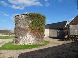 The dovecote of the manor | |
 Coat of arms | |
 Gauciel  Gauciel | |
Coordinates:  49°02′04″N 1°14′34″E / 49.0344°N 1.2428°E / 49.0344; 1.2428Coordinates: 49°02′04″N 1°14′34″E / 49.0344°N 1.2428°E / 49.0344; 1.2428 49°02′04″N 1°14′34″E / 49.0344°N 1.2428°E / 49.0344; 1.2428Coordinates: 49°02′04″N 1°14′34″E / 49.0344°N 1.2428°E / 49.0344; 1.2428 | |
| Country | France |
| Region | Normandy |
| Department | Eure |
| Arrondissement | Évreux |
| Canton | Évreux-3 |
| Intercommunality | CA Évreux Portes de Normandie |
| Government | |
| • Mayor (2020–2026) | Rénald Hamel[1] |
| Area 1 | 7.72 km2 (2.98 sq mi) |
| Population (Jan. 2018)[2] | 831 |
| • Density | 110/km2 (280/sq mi) |
| Time zone | UTC+01:00 (CET) |
| • Summer (DST) | UTC+02:00 (CEST) |
| INSEE/Postal code | 27280 /27930 |
| Elevation | 64–141 m (210–463 ft) (avg. 139 m or 456 ft) |
| 1 French Land Register data, which excludes lakes, ponds, glaciers > 1 km2 (0.386 sq mi or 247 acres) and river estuaries. | |

Gauciel is a commune in the Eure department in northern France.
Population[]
| Year | Pop. | ±% |
|---|---|---|
| 1962 | 122 | — |
| 1968 | 166 | +36.1% |
| 1975 | 483 | +191.0% |
| 1982 | 352 | −27.1% |
| 1990 | 362 | +2.8% |
| 1999 | 422 | +16.6% |
| 2008 | 748 | +77.3% |
See also[]
- Communes of the Eure department
References[]
- ^ "Répertoire national des élus: les maires". data.gouv.fr, Plateforme ouverte des données publiques françaises (in French). 2 December 2020.
- ^ "Populations légales 2018". INSEE. 28 December 2020.
| Wikimedia Commons has media related to Gauciel. |
show
Communes of the Eure department | |
|---|---|
|
This Eure geographical article is a stub. You can help Wikipedia by . |
- v
- t
Retrieved from ""
Categories:
- Communes of Eure
- Eure geography stubs
Hidden categories:
- CS1 French-language sources (fr)
- Articles with short description
- Short description is different from Wikidata
- Infobox mapframe without OSM relation ID on Wikidata
- Coordinates on Wikidata
- Pages using infobox settlement with image map1 but not image map
- Commons category link from Wikidata
- Articles with BNF identifiers
- All stub articles
- Pages using the Kartographer extension