Guiseniers
From Wikipedia, the free encyclopedia
Commune in Normandy, France
Guiseniers | |
|---|---|
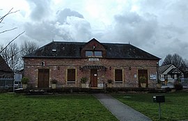 The town hall in Guiseniers | |
 Coat of arms | |
 Guiseniers  Guiseniers | |
Coordinates:  49°12′57″N 1°28′29″E / 49.2158°N 1.4747°E / 49.2158; 1.4747Coordinates: 49°12′57″N 1°28′29″E / 49.2158°N 1.4747°E / 49.2158; 1.4747 49°12′57″N 1°28′29″E / 49.2158°N 1.4747°E / 49.2158; 1.4747Coordinates: 49°12′57″N 1°28′29″E / 49.2158°N 1.4747°E / 49.2158; 1.4747 | |
| Country | France |
| Region | Normandy |
| Department | Eure |
| Arrondissement | Les Andelys |
| Canton | Les Andelys |
| Government | |
| • Mayor (2020–2026) | Philippe Fleury |
| Area 1 | 10.71 km2 (4.14 sq mi) |
| Population (Jan. 2018)[1] | 469 |
| • Density | 44/km2 (110/sq mi) |
| Time zone | UTC+01:00 (CET) |
| • Summer (DST) | UTC+02:00 (CEST) |
| INSEE/Postal code | 27307 /27700 |
| Elevation | 84–158 m (276–518 ft) (avg. 149 m or 489 ft) |
| 1 French Land Register data, which excludes lakes, ponds, glaciers > 1 km2 (0.386 sq mi or 247 acres) and river estuaries. | |

Guiseniers (French pronunciation: [ɡiznje]) is a commune in the Eure department in northern France.
Population[]
| Year | Pop. | ±% |
|---|---|---|
| 1962 | 253 | — |
| 1968 | 289 | +14.2% |
| 1975 | 237 | −18.0% |
| 1982 | 291 | +22.8% |
| 1990 | 388 | +33.3% |
| 1999 | 382 | −1.5% |
| 2008 | 409 | +7.1% |
See also[]
- Communes of the Eure department
References[]
- ^ "Populations légales 2018". INSEE. 28 December 2020.
| Wikimedia Commons has media related to Guiseniers. |
show
Communes of the Eure department | |
|---|---|
|
| show Authority control | |
|---|---|
| General |
|
| National libraries | |
This Eure geographical article is a stub. You can help Wikipedia by . |
- v
- t
Retrieved from ""
Categories:
- Communes of Eure
- Eure geography stubs
Hidden categories:
- Articles with short description
- Short description is different from Wikidata
- Infobox mapframe without OSM relation ID on Wikidata
- Coordinates on Wikidata
- Pages using infobox settlement with image map1 but not image map
- Commons category link from Wikidata
- Articles with VIAF identifiers
- Articles with BNF identifiers
- Articles with WorldCat-VIAF identifiers
- All stub articles
- Pages using the Kartographer extension